


Introduction
Whilst some hilltops were defined by walls, banks, or ditches in the Neolithic and Bronze Age, the Iron Age in Europe is characterized by the widespread emergence of hillforts during the seventh to fifth centuries bc. That is not to say all were built at the same time or for the same reason. In fact, there is great variability. Some hillforts were enormous, enclosing tens of hectares, while others encompassed little more than a few thousands of square metres. Some were intensively occupied by hundreds of inhabitants whereas others were not permanently occupied, if at all. Some were long-lived with continuous activity over several centuries, others were used only intermittently, or went out of use almost immediately after their construction. Most were simply defined by a single line of wall or earthen bank, but a few were demarcated by multiple boundaries and possessed elaborate entranceways. Their variability warns against over-generalisation and clearly suggests that they were integrated into diverse, and regional, economic and social systems. Yet hillforts also have many common characteristics that may imply the development of a shared ‘vocabulary of power’ during the Iron Age across Europe. They were usually located in prominent topographic positions that were intended to visually dominate the surrounding landscape. The scale and sometimes complex architecture of their boundaries indicate that they were key media for symbolic activity and display, while the physical act of enclosure provided a focus for some social and economic activities within a specialized space separated from the normal daily routines within fields and farmsteads.
The interpretation of hillforts is inextricably linked with the interpretation of European Iron Age societies. Most archaeologists would agree that hillforts were the physical manifestation of some kind of authority, of which a few can be described as genuine ‘centres of power’. The obvious question though is whose authority and whose power was embodied through the creation and use of these sites? For some, Iron Age societies throughout Europe were markedly hierarchical and hillforts acted as both tribal capitals and the residences of elite individuals (e.g. Kimmig, Reference Kimmig, Otto and Herrmann1969; Cunliffe, Reference Cunliffe1984b, Reference Cunliffe1997: 51–63; Dietler, Reference Dietler, Arnold and Gibson1995; Krausse et al., Reference Krausse, Fernández-Götz, Hansen and Kretschmer2016). In this sense, the size and complexity of the hillfort boundaries and the intensity and types of activity within their confines reflected the status and social networks of the occupying lineage. This position, in Britain at least, has been extensively critiqued in recent years. Boundary construction, for instance, has been interpreted as a largely symbolic act defining the relationship between the communities involved (see especially Sharples, Reference Sharples2010), whilst I, amongst others, have highlighted that the internal layouts of many British hillforts appear to emphasize social conformity rather than promote social differences (Davis, Reference Davis2015). In this sense, hillforts in Britain have come to be interpreted as an expression of the prestige of a community rather than of an individual (Collis, Reference Collis and Fichtl2010; Sharples, Reference Sharples2010; Lock, Reference Lock2011; Davis, Reference Davis2013).
In this article I want to test and critique these paradigms by comparing the evidence from two of the best-known hillforts in Europe: Danebury in Wessex, southern Britain, and the Heuneburg in Baden-Württemberg, south-western Germany (Figure 1). While the two hillforts occupy almost entirely unconnected regions of western Europe during the Iron Age, several factors make these sites ideal case-studies for such an investigation. Despite their relatively modest size (neither site encloses a hilltop of more than 5 ha, although there is extensive extra-mural settlement at the Heuneburg), both have been subject to large area excavations over many years (Cunliffe, Reference Cunliffe1984a, Reference Cunliffe1984b, Reference Cunliffe1995; Kimmig, Reference Kimmig1983; Gersbach, Reference Gersbach1989, Reference Gersbach1995, Reference Gersbach1996; Kurz, Reference Kurz2007, Reference Kurz and Krausse2008, Reference Kurz and Krausse2010). These have produced enormous assemblages of material as well as complex stratigraphic sequences. This has allowed the patterns of construction and occupation over a period of several hundred years to be identified in detail; this is only rarely achieved and marks these hillforts out as archaeologically exceptional. We are thus able to confidently analyse the spatial layout within these hillforts and track changes over time as well as understand something of the relationship between the people who lived in, used, or visited these hillforts.
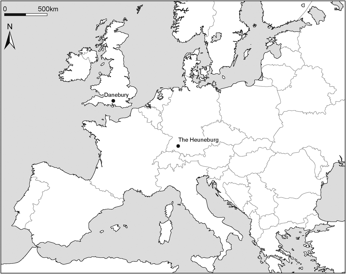
Figure 1. Map showing the location of Danebury and the Heuneburg.
This article begins by providing an overview of Iron Age hillforts in Wessex and south-western Germany before embarking on an analysis of the structural phases of Danebury and the Heuneburg and a detailed investigation of the organisation their internal space. It is suggested that the repeated acts of boundary construction and renewal at both sites helped define the relationships between the communities involved in their construction rather than simply reflecting the power of individual elites. The internal architecture of the sites is argued to be structured according to what anthropologists would call ‘the spatial logics of materialized ideology’, i.e. a guiding set of ideals for how space should be structured, reflecting the character of political power or that of an authority in the constructed environment (DeMarrais et al., Reference DeMarrais, Luis and Earl1996). In this sense, social ideologies are manipulated and internalized through the embodied experience of dwelling within a particular spatial environment. Despite being the materialisation of differing social structures, the occupational sequences at Danebury and the Heuneburg display some remarkable synergies such as little obvious evidence for marked social differences, particularly during the early phases. This is argued to be a conscious attempt to create a shared sense of community as a strategy to negotiate the difficulties encountered by large groups of people used to living in relatively small, discrete, settlements, dwelling together in close proximity within centralized settlements. There are also significant variations, particularly in the ways in which wider occupation was organized outside the hillfort interiors. Partly this is a product of demographic scale, but it is also thought to be a result of different ways that access to land and resources was controlled within these societies. Finally, I consider whether the similar patterns of residence at these hillforts can be identified at other centralized settlements throughout Europe in later prehistory.
The Early and Middle Iron Age in Wessex, Southern Britain
The area of southern England known as Wessex (broadly encompassing the modern counties of Hampshire, Dorset and Wiltshire) has, since the beginnings of archaeological study in the country, been considered a ‘key’ region for the investigation and interpretation of the Iron Age in Britain (see Sharples, Reference Sharples2010: 9–12). Hillforts represent some of the most visually obvious and well-preserved evidence for the period in the region and there are large numbers of them, particularly on the chalk downland (e.g. Palmer, Reference Palmer1984; McOmish et al., Reference McOmish, Field and Brown2002; Payne et al., Reference Payne, Corney and Cunliffe2006; see also the online Hillfort Atlas database [Lock and Ralston, Reference Lock and Ralston2017] for a complete gazetteer of hillforts in Britain). Many have been investigated to varying degrees over the last 100 years, but the most well-known and extensively excavated is that of Danebury in Hampshire (Cunliffe, Reference Cunliffe1984a, Reference Cunliffe1984b, Reference Cunliffe1995; Cunliffe & Poole, Reference Cunliffe and Poole1991a, Reference Cunliffe and Poole1991b), and it has become fundamental to any discussion of the period not only in Wessex, but all of Britain.
During the first half of the twentieth century, the emergence of hillforts in Britain were seen as the consequence of successive invasions of Celtic peoples from continental Europe, which had forced the native Britons to defend themselves (Hawkes, Reference Hawkes1931). In a manner resembling the misconceptions surrounding Britain's Brexit vote of 2016, the archaeological belief in the mass folk movement of continental Europeans into Britain was derived mainly from the writings of a populist, ambitious self-aggrandiser, in this case Julius Caesar, rather than a demonstrable empirical reality. A sustained critique led by Frank Roy Hodson (Reference Hodson1960, Reference Hodson1962, Reference Hodson1964) and Graham Clarke (Reference Clarke1966) systematically destroyed the basis of such invasionist theories, and by the late 1960s hillforts had come to be seen as indigenous developments.
Since the 1970s there has been an enormous increase in the quantity and quality of the investigation of hillforts, exemplified by Barry Cunliffe's twenty-year programme at Danebury. This means that we now have a good understanding of the development and use of hillforts in Wessex, although this is by no means uncontroversial. A range of interpretations now exists, but these have become polarized behind two dominant positions. On one side are those who consider hillforts to be the elite residences of tribal leaders and central places of social, economic, political, and religious systems (Cunliffe, Reference Cunliffe1984b; Karl, Reference Karl, Moore and Armada2011; Driver, Reference Driver2013). On the other side are those who regard hillfort societies as very communal in emphasis and ideology, lacking marked social distinctions (Collis, Reference Collis and Guilbert1981; Sharples, Reference Sharples1991a, Reference Sharples2010; Hill, Reference Hill, Champion and Collis1996; Lock, Reference Lock2011; Davis, Reference Davis2015). In an important contribution, J.D. Hill (Reference Hill, Moore and Armada2012) has recently considered in detail how such societies lacking central authority and sharp distinctions of rank may have worked. He has likened some Iron Age societies in Wessex to African ‘segmentary’ societies. In these systems, power is distributed broadly equally between heads of households (segments) who largely run their own affairs. Such social forms have also been labelled heterarchies (e.g. Crumley, Reference Crumley, Ehrenreich, Crumley and Levy1995) and are defined by greater horizontal rather than vertical social distance within a society. In practice, the Iron Age household was unlikely to be entirely independent, but would have required alliances and reciprocal relationships with neighbours for social and economic reproduction. Key to this was the defence of shared resources organized at a community level. Such communities were defined by clusters of households who combined as a result of close kinship ties, shared interests, and shared locality. These entities were physically manifested through the construction and occupation of hillforts. To a certain extent the excavations at Danebury have formed the basis for much of this discussion and this is what I want to explore in this section.
Danebury: sequence and interpretation
Danebury hill is a distinctive landmark. It is surrounded by the remains of Middle Bronze Age field systems, and set within a large area of dry chalk downland (Figure 2). Twenty-two structural periods have been identified at Danebury, ranging from the Late Bronze Age to Late Iron Age (c. 700 bc–ad 50) (Cunliffe, Reference Cunliffe1995: table 3) (Figure 3). Detailed aerial photographic survey and excavation within Danebury's environs over the last thirty years (Palmer, Reference Palmer1984; Cunliffe, Reference Cunliffe2000; Cunliffe & Poole, Reference Cunliffe and Poole2000a–Reference Cunliffe and Pooleg) mean that we possess an unparalleled understanding of the development of both the hillfort and its landscape in the later first millennium bc (summarized here in Supplementary Table 1).

Figure 2. Danebury in its landscape setting. Note the absence of field systems to the west of the hillfort which may have been managed as open pasture for livestock (after Palmer, Reference Palmer1984).

Figure 3. Simplified schematic plans of key periods of occupation at the hillfort of Danebury (after Cunliffe & Poole, Reference Cunliffe and Poole1991a, figs. 4.151–53).
The first construction of a boundary enclosing the hilltop was in the Late Bronze Age (c. 700–500 bc) (Period 0). Known as the ‘outer earthwork,’ this was a relatively slight ditch enclosing an oval area of around 16 ha. There is little evidence for occupation and the Late Bronze Age site is argued to be a hilltop enclosure of which a number have been identified in Wessex and considered to cater for seasonal gatherings and the exchange of livestock (Cunliffe, Reference Cunliffe and Poole1991a: 234; Cunliffe, Reference Cunliffe, Payne, Corney and Cunliffe2006: 155–56, Maltby, Reference Maltby, Wainwright and Davies1995). Dispersed throughout the landscape, were a range of enclosed farmsteads. Several of the larger enclosures appear to contain at least one large and elaborate roundhouse, and they have been interpreted as the homesteads of important aristocratic families (Cunliffe & Poole, Reference Cunliffe and Poole2008), although they could also have been communal structures for gatherings (Sharples, Reference Sharples2013). There is little else, such as elaborate burial monuments, to suggest marked social distinctions between groups at this time; instead these groups were likely to be bound together through kinship alliances and reciprocal relationships established by the regular exchange of marriage partners, labour, and, most importantly, bronze.
Early in the fifth century bc (c. 470 bc), the hillfort was first established (Periods 1a–1c) characterised by the construction of a 3.5 m high, timber-box rampart with two opposing entrances. Within the hillfort, clusters of small roundhouses and storage buildings, were loosely scattered around the interior. Each cluster probably represented an individual household who had moved into the hillfort after its construction perhaps from those settlements situated closest to the hill. The resident population at this time was probably relatively small, numbering fewer than 100 individuals (Davis, Reference Davis2013: 367).
The emergence of the hillfort at Danebury during the Early Iron Age is mirrored elsewhere in the surrounding landscape. A number of other hillforts, such as Woolbury (Cunliffe & Poole, Reference Cunliffe and Poole2000a) and Quarley Hill (Hawkes, Reference Hawkes1939), were also constructed at this time. The hillforts appear to be broadly similar in size and located some 6–10 km apart. Their construction coincides with the demise of long-established exchange networks, including the abandonment of bronze as a key exchange commodity and is likely to be linked. The interiors of these hillforts appear sparsely occupied, but an increasing number of smaller enclosed farmsteads colonized the land surrounding them. Presumably these represent the homesteads of individual households in which social and political power remained with the head of the household, and a broader community existed only in its periodic assembly at hillforts. The increasing number of farmsteads suggests an increasing population with power relationships and alliances articulated through hillfort construction rather than the exchange of bronze.
The fourth and early third centuries at Danebury (c. 310–270 bc) were characterized by an almost obsessive interest with its boundaries (Periods 2a–5). The gateways were remodelled several times before and after destruction by fire (Period 2c). The inner rampart was refurbished and regularly (possibly annually) maintained. The outer rampart was also re-modelled and made much more substantial, and the middle rampart encircling the southern half of the hillfort was constructed. The inner rampart was also remodelled in ‘glacis style’ creating a continuous slope of chalk, which, when freshly constructed would have possessed a gleaming white appearance impossible to miss amongst the more muted tones of the downland.
Periods 6i–7 (third to first centuries bc) were marked by an increase in the intensity of occupation within the hillfort and a corresponding decrease in interest in the boundaries. The most dramatic change occurred during Periods 6vi–vii which was characterized by very intensive occupation by a sizeable population numbering perhaps over 300 (Cunliffe, Reference Cunliffe2003: 92–93, but revised by Sharples, Reference Sharples, Fernández-Götz, Wendling and Winger2014: 228). A large number of roundhouses of similar size, with predominantly east-facing entrances, were packed into neat rows in the lee of the ramparts. This change in the nature of occupation within the hillfort appears to coincide with a change in patterns of residence in its environs. Analysis of the landscape around Danebury suggests that the hillfort was surrounded by an inner and outer zone, a situation also present at other Middle Iron Age ‘developed’ hillforts in Wessex such as Maiden Castle (Sharples, Reference Sharples2010: 76). Within the inner zone (i.e. the area of agricultural land within 6 to 10 km that was easily workable from the hillfort), all the small enclosures and other hillforts (such as Quarley Hill and Woolbury) were abandoned and the households presumably absorbed into the interior of Danebury. In the outer zone (i.e. from 10 to 20 km), some settlements continued, but their enclosing boundaries were abandoned.
This arrangement may have lasted for several decades before the regular rows of houses within Danebury were replaced by loose scatters of two or three buildings (Period 6viii). It is possible that this was the result of a relocation of population, given that by the first century bc farmsteads once again began to appear in the surrounding landscape. Iron Age occupation at Danebury ended around the middle of the first century bc (c. 50 bc), in a manner that was probably both sudden and violent. The eastern gateway was destroyed by fire and the remaining houses inside the hillfort were burnt.
Cunliffe (Reference Cunliffe1984b: 550–54) has offered a detailed interpretation of the later prehistoric use of Danebury and, by extension, other similar hillforts in Wessex. He considers that the hillfort rose to a position of prominence within a large territory because it fulfilled an increasing range of central place functions including production, storage and redistribution. As such, Cunliffe interpreted the site as the high-status settlement of a king along with his retinue of warriors and skilled men (Reference Cunliffe1984b: 554).
The model was attacked almost immediately. John Collis (Reference Collis1985: 349) disagreed fundamentally with Cunliffe's interpretation of an Iron Age social structure which was apparently based entirely on analogy with a generalized ‘Celtic’ society derived from early medieval Irish law tracts. It became particularly difficult to sustain a ‘king of the castle’ model for Danebury when, as Cunliffe himself admitted, ‘…nothing among the surviving material culture at Danebury indicates the presence of an individual or family of pre-eminent status’ (Reference Cunliffe1984b: 559). The role of Danebury as a centre for the production and distribution of material culture has also seen sustained criticism (Stopford, Reference Stopford1987; Sharples, Reference Sharples1991a, Reference Sharples2010; Morris, Reference Morris1994; Hill, Reference Hill, Champion and Collis1996). Hill (Reference Hill, Champion and Collis1996) in particular demonstrated conclusively that production at Danebury was no greater than at non-hillfort sites, while Morris (Reference Morris1994) and Sharples (Reference Sharples2010) have questioned the significance of long-distance exchange, the latter arguing that hillfort communities were rather introverted.
This leaves us with the question: how should we understand Danebury and other similar hillforts in Wessex? The absence of central place functions means that they are seldom considered to be urban settlements in the way that the Fürstensitze such as the Heuneburg have been in recent years (Collis, Reference Collis and Guilbert1981; see Sharples, Reference Sharples, Fernández-Götz, Wendling and Winger2014). Yet this rather misses the point. What should be emphasized is that hillforts like Danebury represent a significant shift away from any type of previous settlement organisation in terms of both scale and intensity of occupation. They indicate new, centralized forms of living together that required new ways of articulating, negotiating, and mediating power relations between households, kin, and individuals.
The Early Iron Age in South-Western Germany
In continental Europe, the most well-known hillforts are the Fürstensitze, or ‘princely seats’, of the West Hallstatt region (essentially eastern France, south-western Germany and western Switzerland). Interpretations of the Fürstensitze have been heavily influenced by Wolfgang Kimmig. Writing in the late 1960s, Kimmig (Reference Kimmig, Otto and Herrmann1969) defined the Fürstensitze as political and administrative central places characterized by the presence of Mediterranean imports and associated with richly furnished burial mounds (Fürstengräber). These associations formed the basis of a model comparable to a medieval feudal society in which the Fürstensitze functioned in the same way as medieval burgs, i.e. they were essentially seen as the residence of a lord and his entourage who controlled the production, acquisition, and supply of elaborate and exotic artefacts. In recent years the validity of the feudal model and the Fürstensitz/Fürstengrab association has been rightly challenged (Arnold, Reference Arnold, Arnold and Gibson1995, Reference Arnold and Bolender2010; Biel & Krausse, Reference Biel and Krausse2005). Bettina Arnold (Reference Arnold, Arnold and Gibson1995: 47), for instance, has highlighted that there are many Fürstengräber not associated with Fürstensitze, which she argues implies that high-status individuals were dispersed throughout the landscape rather than necessarily resident at the Fürstensitze. However, the idea that the societies of this West Hallstatt zone possessed a markedly hierarchical social and political structure remains the dominant narrative (Frankenstein & Rowlands, Reference Frankenstein and Rowlands1978; Dietler, Reference Dietler, Arnold and Gibson1995; Krausse et al., Reference Krausse, Fernández-Götz, Hansen and Kretschmer2016). Excavations over the last 70 years at the Heuneburg and their subsequent publication (Kimmig, Reference Kimmig1983; Gersbach, Reference Gersbach1989, Reference Gersbach1995, Reference Gersbach1996; Kurz, Reference Kurz2007, Reference Kurz and Krausse2008, Reference Kurz and Krausse2010) mean that the site is the most thoroughly investigated Fürstensitz and consequently much of the debate about Late Hallstatt society is focused around the interpretation of this site (e.g. Arnold, Reference Arnold and Bolender2010; Fernández-Götz & Krausse, Reference Fernández-Götz and Krausse2012, Reference Fernández-Götz and Krausse2013).
The Heuneburg: sequence and interpretation
The Heuneburg is a relatively small, triangular-shaped, unprepossessing, hilltop plateau immediately adjacent to a stretch of the upper course of the river Danube (Figure 4). The hillfort has a long and complex history: twenty-three structural periods have been identified on the plateau dating from the Neolithic to the Middle Ages and they can be related to activity in the immediate environs (the ‘lower town’ and ‘outer settlement’) and broader landscape (see Figure 5 and summary in Supplementary Table 2).

Figure 4. The Heuneburg and its immediate surroundings. Note the extensive remains of settlement enclosures to the west of the hilltop plateau dating to periods IVb3–a/1 (after Krausse et al. Reference Krausse, Fernández-Götz, Hansen and Kretschmer2016, fig. 80 and Fernández-Götz & Krausse, Reference Fernández-Götz, Krausse, Fontaine and Helas2015, fig. 4).

Figure 5. Simplified schematic plans of occupation sequence at the Heuneburg (after Kurz, Reference Kurz2007, fig. 1).
The earliest enclosure (Periods VIII/2–VIII/1) dates to the Neolithic, but during the Middle to Late Bronze Age (c. 1600–1100 bc) the hilltop plateau was defined by an enormous earthwork bank, 3.6 m high and 20 m wide at the base, capped by a timber box-built wall (structural phases VII–Vb). Within the centre of the enclosure, a ditch, several metres deep, divided the area into two and contained a variety of four-post storage buildings and larger workshops or houses. It has been argued from the scale of the enclosure boundary that the site was a permanently occupied central place of some importance at this time (Krausse et al., Reference Krausse, Fernández-Götz, Hansen and Kretschmer2016: 47).
There is no evidence for Bronze Age settlement on the plateau after 1100 bc, but by 800 bc an increasing number of farmsteads emerged in the landscape surrounding the hilltop (Kurz, Reference Kurz and Krausse2008). Even at this time, there is increasing evidence for the emergence of marked social stratification. Recent excavations of two, richly-furnished burial mounds in the ‘Speckhau’ group around the Hohmichele in the area of the Heuneburg have demonstrated that they belong to the Hallstatt C phase and suggest that status differentiation in this period was already established (Arnold & Murray, Reference Arnold, Murray, Krausse, Kretschmer, Hansen and Fernández-Götz2015; Fernández-Götz & Arnold, Reference Fernández-Götz, Arnold, Schumann and van der Vaart-Verschoof2018: 190). The construction of monumental barrows also suggests that the dead were deployed as a key political resource in West Hallstatt society in ways that were not used in Wessex. Arnold (Reference Arnold and Bolender2010), for instance, has argued that the organisation of the mortuary landscape, with its clustering of mounds, indicates a social system based on kinship ties in which groups were laying claims to particular areas of the landscape.
In the late seventh century bc (Hallstat D1 phase) the hilltop plateau was reoccupied (Period IVc). A 4 m wide box-built timber wall was constructed on the remains of the Bronze Age boundary. Scattered within the interior of the enclosure, several clusters of buildings defined by palisades were constructed. It has been argued that these represent the agglomeration of previously independent rural settlement groupings into a single political entity (Krausse et al., Reference Krausse, Fernández-Götz, Hansen and Kretschmer2016: 48).
Around 600 bc (Period IVb3), the boundaries were entirely remodelled and internal occupation restructured. A wall made of mudbricks with projecting bastions was constructed on a limestone plinth. The choice of limestone is interesting: it is not local to the hilltop and must have been brought from a considerable distance away. The choice of mudbrick as a constructional material and the architectural use of bastions are extremely unusual in temperate Europe, but paralleled in the Mediterranean world. Kimmig (Reference Kimmig1983), amongst others, has suggested that the mudbrick wall came about because a well-travelled or Greek architect was used by local leaders who were able to persuade the hillfort community of the benefits of this new kind of boundary. Arnold (Reference Arnold and Bolender2010: 105–6) has argued that the clinching argument may have been the ‘competitive display advantage’ that mudbrick provided over timber and earth: once white-washed the mudbrick wall would have been a startling presence on what is a relatively unimposing hilltop plateau.
Within the enclosed area on the plateau the buildings of Period IVc were demolished and rows of structures arranged along streets were established. The buildings were all similar in size and separated by drainage ditches and fences. Immediately outside the hilltop plateau, the earth and timber boundaries of the lower town were constructed as well as an elaborate gatehouse. Surrounding the plateau and lower town was an outer settlement stretching over an area of 100 ha. Settlement was not densely built up, but divided by ditches into quarters which each contained a number of rectangular palisaded farmsteads, around 1 ha in size, arranged neatly in rows. Krausse et al. (Reference Krausse, Fernández-Götz, Hansen and Kretschmer2016: 84) have argued that the division of the outer settlement into quarters may have been an attempt to express the distinctiveness of different lineage groups joined together through the process of the Heuneburg's construction.
The mudbrick wall lasted for 70 years before it was destroyed, along with the outer settlement, in a catastrophic fire around 540/530 bc. The boundary was rebuilt, but using ‘traditional’ methods of earth and timber boxes, not mudbrick. The outer settlement was abandoned, the density of settlement in the lower town increased while the occupation on the hilltop plateau was entirely reorganized: the uniform, regular rows of buildings of the previous period were replaced with looser scatters of building clusters. Some of the structures were enormous—the so-called Herrenhäuser. They have been interpreted as the homesteads of prestigious families (Gersbach, Reference Gersbach1996), but a use as communal structures is also possible. The implication is that the changes represent a significant ideological change, possibly after an armed conflict (Arnold, Reference Arnold and Bolender2010). Another catastrophic fire brought this period to an end in c. 490 bc, although the boundary was rebuilt and internal occupation on the hilltop followed the previous arrangement. The lower town was even more densely occupied at this time, but the architecture was more uniform, in contrast to the preceding periods. The Iron Age occupation of the Heuneburg is thought to have ended around 450 bc, again in a fire.
The most influential interpretation of the Heuneburg was offered by Kimmig (Reference Kimmig, Otto and Herrmann1969, Reference Kimmig1983), who established a model of social and political organisation analogous to that of a feudal society. Within this paradigm, the Heuneburg was the residence of a prince and his retinue of skilled men and warriors. Power was attained from the control and redistribution of prestige items, particularly exotic goods derived from the Mediterranean world, while the episodes of boundary destruction have been interpreted as dynastic takeovers (Narr, Reference Narr1972; Arnold, Reference Arnold, Arnold and Gibson1995).
The introduction of Mediterranean goods into the West Hallstatt zone, particularly after the founding of Massalia on the southern French coast by Ionian Greeks in 600 bc, has long been seen as the catalyst for the emergence of the Heuneburg (Frankenstein & Rowlands, Reference Frankenstein and Rowlands1978). However, such a position has been increasingly attacked in recent years (Arnold, Reference Arnold and Bolender2010; Fernández-Götz & Arnold, Reference Fernández-Götz, Arnold, Schumann and van der Vaart-Verschoof2018). The identification of elite graves dating to Hallstatt C (eighth to seventh century bc) clearly indicates rising inequalities and increased social complexity much earlier than initial contacts with the Mediterranean world (Fernández-Götz & Arnold, Reference Fernández-Götz, Arnold, Schumann and van der Vaart-Verschoof2018: 186). In this sense, links with Massalia can be seen as relatively unimportant during the initial periods of Early Iron Age occupation at the Heuneburg and the emergence of the hillfort should be considered primarily as a result of indigenous developments. Krausse et al. (Reference Krausse, Fernández-Götz, Hansen and Kretschmer2016: 160) in particular have argued that the construction of the hillfort was a result of the desire for centralisation by native social elites who required stable conditions in order to conduct successful exchanges.
Creating Communities: Danebury and the Heuneburg in Context
From the analysis of the sequences at Danebury and the Heuneburg it is clear that there are significant differences, but also significant similarities in the Iron Age activity at these hillforts. These can be summarized as:
• A shared interest in the monumentality of the boundaries and construction events;
• Similar low density, dispersed settlement during early phases with a subsequent change to organized internal layouts;
• Differential scale and nature of occupation outside of the hillfort interiors;
• Variable later histories and social trajectories.
This section will consider each of these in turn. It would not be wise to argue that any observed synergies are the result of direct cultural contact or exchange, since the sites are geographically distant and asynchronous (main period of Iron Age occupation at the Heuneburg spans 630–450 BC and at Danebury 470–50 BC). However, the intention here is to rethink the significance of their similarities and differences in terms of the ways that increasing social complexity and centralisation was managed.
Monumentality of the boundaries and construction events
Perhaps the most important commonality is the shared interest in the monumentality of the hillfort boundaries, and the repeated acts of construction, destruction and reconstruction. At Danebury, boundary construction and modification appears almost continuous, whereas at the Heuneburg it is more episodic. Features such as the Heuneburg's mudbrick wall or Danebury's glacis rampart would have been visually stunning and involved an extravagant use of resources which could have been easily avoided if an alternative method of enclosure had been employed. The interpretations of these boundaries have tended to see them as resulting from elite control and display. In recent years, however, in Britain there has been a growing emphasis placed on the social implications of participation in boundary construction events as a means of binding communities together (Sharples, Reference Sharples, Haselgrove and Pope2007; Brown, Reference Brown2009; Lock, Reference Lock2011; Davis, Reference Davis2015). Niall Sharples in particular (Reference Sharples2010) has interpreted construction events as key arenas for the negotiation of social relationships between communities. For Sharples, gift exchange formed the principal means of formalizing relationships between individuals and communities in later prehistoric societies. However, such activity, he argues, was not limited to the exchange of material, but could also encompass the exchange of human labour. The construction of hillfort boundaries would have involved the labour of large numbers of people brought together by the future occupants. These participants would provide their labour because they were already bound together by long-standing reciprocal obligations established through the regular exchange of material.
The construction events thus functioned as symbolic acts that helped define the relationships between communities. Labour was provided as a gift to pay social debts and the boundaries themselves remained as a visible mnemonic of those relationships. Boundaries as a physical representation of social relationships could also be referenced through the materials used in construction. At the hillfort of Maiden Castle, Dorset, for instance, a large quantity of non-local limestone blocks was used to refurbish the eastern entrance around 400 bc (Sharples, Reference Sharples1991b: 76). Sharples (Reference Sharples2010: 117–19) argues that the use of such material is likely to have played a role in creating links between landscape, people and place: people entering Maiden Castle and seeing the limestone would be visibly reminded of the relationship between the occupants of the hillfort and communities living elsewhere in the landscape.
The enormous multiple rampart and ditches at Danebury were likely to be under almost constant construction for a considerable amount of time. If we accept that the hillfort was not a pre-eminent centre for the production and exchange of material culture, then the constant interest in the boundaries could be interpreted as a result of the competitive exchange of labour between the surrounding communities and the occupants. The boundaries would have come to be seen as a physical manifestation of that relationship between those communities, rather than enhancing the prestige of a resident king. The use of timber to create the initial box-rampart may have been a visible reminder of the link between people and particular wooded places. The creation of the glacis style boundary in Period 5 clearly marked a major transformation which enhanced the visibility of the boundary, but also significantly altered its physical materiality. The dramatic change from timber to earth and stone may have reflected the establishment of new relationships between people inhabiting different parts of the landscape. Importantly this broadly coincides with the abandonment of other hillforts in the vicinity and suggests that the territory under the influence of the community at Danebury had increased in size, absorbing new groups and areas of the surrounding countryside.
How then should we understand the boundaries at the Heuneburg? Clearly the material culture recovered from the Fürstengräber and from the Heuneburg itself suggests that social competition within this society was not restricted to boundary construction, but principally encompassed the acquisition and consumption of material. This is important and may partly explain why construction events at the Heuneburg were apparently episodic, but also colossal. In the Late Bronze Age to Early Iron Age (Halstatt B–C, c. 1000–620 bc), the evidence suggests that there was systematic settlement of the area around the Heuneburg, with increasing evidence for rural farmsteads. Relationships between these independent communities were created through the exchange of material culture, principally agricultural surplus for wealth objects such as ironwork. Competition and careful manipulation of these exchange relationships between these relatively dispersed communities provided the conditions for the emergence of elites, but these were unstable and liable to collapse because of the pressure of sustaining such exchange relationships. The creation of centres like the Heuneburg may have been a result of the desire of elite groups to create more stable social conditions where production and consumption of wealth objects could be tightly controlled. To stage the initial construction event required careful planning and manipulation of these exchange relationships over extended periods in order to accrue sufficient gift debts and surplus food. The scale of the boundary in Period IVc suggests that a very large group of participants was brought together by the future occupants from the surrounding communities. The boundary would then become a physical representation of those relationships and its location and form was an important medium through which these relationships were articulated. The boundary was built directly on top of the Bronze Age rampart, which must still have been a significant feature. This could have helped to legitimize Iron Age activity by establishing a direct connection between past and present (Ferńandez-Götz Reference Fernández-Götz, Fernández-Götz, Wendling and Winger2014). This was reinforced by the use of traditional construction methods which would have stood as a visible mnemonic for the communities involved. The enormous quantities of timber required may have been sourced from particular locations within the immediate vicinity, helping to establish a locational relationship between the hillfort community, its landscape, and its people. Boundary construction in this society may have acted to establish or confirm relationships which were subsequently maintained through the regular gift exchange of material rather than labour.
This initial boundary may have stood for 30 years before it was replaced by the mudbrick wall. This period coincides with the densest occupation at the Heuneburg, when the hilltop plateau, lower town, and outer settlement were at their greatest extent (Krausse et al., Reference Krausse, Fernández-Götz, Hansen and Kretschmer2016: 70). The total population was very large, perhaps as many as 5000 people (Fernández-Götz & Krausse, Reference Fernández-Götz and Krausse2013: 478). Such a population would have required copious supplies of food, probably procured beyond the agricultural capacity of the immediate vicinity. This is supported by an analysis of the provenance of livestock through isotopic analysis of their remains (Stephan, Reference Stephan, Krausse, Fernández-Götz and Kretschmer2016: 68–70). According to the strontium isotope ratios, some cattle, sheep, and pigs were imported from significant distances at this time (even up to 100 km away), which suggests that exchange relationships had been established with livestock-producing communities located some distance away. In part this may help explain the reason for the construction of the boundary and the choice of mudbrick. The implication is that the size of the territory and number of communities under the control of the authority at the Heuneburg had significantly increased and the reconstruction of the boundary was a means to formally establish these new relationships. Arnold (Reference Arnold and Bolender2010: 106) has argued that its construction was a form of ‘corvée labour’ symbolizing the allegiance of the groups involved to its builder. This is slightly misleading because it assumes that participants gave their labour as a form of levy or tithe to a lord when actually it may also have been embedded within gift exchange relationships. If we think of the boundary as representing the manifestation of social relationships, then the materiality of the mudbrick wall was deliberately different and exotic, perhaps a visible reminder of the extensive territory and communities now under its influence. It also incorporated elements such as limestone and sandstone which had to be quarried and brought to the site from some distance away. The use of stone from different sources has been argued by Bettina Arnold and Manuel Fernández-Götz (Reference Arnold, Fernández-Götz, Ballmer, Fernández-Götz and Mielke2018) as a kind of communal symbolism in which people effectively built material from their homes into the fortification system.
The mudbrick wall was destroyed by fire and demolished to its stump. This has been interpreted as a violent reaction reflecting deep ideological change, possibly even a dynastic takeover (Gersbach, Reference Gersbach1982). Again, we should perhaps also consider this act as symbolizing the changing nature of community relationships. Certainly, after the destruction of the mudbrick wall, the population appears to decrease and retreat within the boundaries of the hilltop plateau and lower town. The boundary is rebuilt, but this time in the traditional earth and timber box method. This may have been a very visible reminder that the relationship between the occupants and the surrounding communities had changed. Isotopic evidence of livestock at this time (Stephan, Reference Stephan, Krausse, Fernández-Götz and Kretschmer2016) indicates that the vast majority of animals were raised in the local area and suggests a re-focus on the immediate surroundings.
Change from dispersed occupation to organized layouts of hillfort interiors
The other significant point of similarity between the two hillforts is the nature of occupation: it appears to move from a sparsely occupied interior and densely occupied countryside to a densely occupied interior and sparsely occupied countryside. In one sense, if the boundaries were a physical manifestation of the relationship between the occupants and surrounding communities, then the architecture and layout of the interior were an expression of the relationship between the occupants. Anthropologists have long argued that meanings and social ideologies are materialized through the constructed environment in what has come to be known as ‘spatial logics’ (DeMarrais et al., Reference DeMarrais, Luis and Earl1996; McIvor, Reference McIvor2015). In other words, the particular arrangement of architecture and space can be manipulated so that the embodied experience of dwelling within it masks or accentuates one's social condition. Settlement layouts can thus reflect variable ideologies such as communal solidarity or social inequality which are reinforced through the physical experience of living and acting within such an environment.
It is interesting to note that after the construction of the original hillfort boundary at both the Heuneburg and Danebury, occupation within the interior of the hillforts indicates that there was a relatively low population living in clusters of buildings scattered around the interior. The buildings presumably represent a range of houses, workshops, and storage buildings and demonstrate variability in design and size. The residential arrangement at this time was therefore characterized by a low density of built space and areas of open space between the groups of buildings. The latter presumably represent extended family or kin groups who had moved into the hillfort from the immediate surroundings. The settlement layout, or spatial logics, points to an attempt to define spatially and presumably socially independent units within the enclosed areas. The implication is that the rural settlement and social pattern had been recreated within the hillforts.
Period IVb3–a/1 at the Heuneburg and Period 6vi–vii at Danebury were marked by significant change, with the previous pattern of occupation being completely reorganized. Buildings during these periods were practically identical, of similar size, and crammed into regular rows. At Danebury these were concentrated in the lee of the ramparts, but at the Heuneburg the entire hilltop was covered. The evidence suggests very dense occupation by a considerable population at both sites at this time. The arrangement is suggestive of significant planning, presumably by whatever authority controlled the hillforts and implies that the spatial order was manipulated to emphasize a new ideology. At Danebury this spatial arrangement has been argued to have been a strategy to blur the distinctions between individual households and strengthen the importance of the larger community (Davis, Reference Davis2013). Can we envisage a similar scenario at the Heuneburg? The similar dimensions of the buildings and their arrangement in neat rows appear to be a conscious attempt to reduce obvious status distinctions between the residents and increase the sense of communal solidarity. The fences and drainage ditches separating the buildings however presumably represent property boundaries and suggest that individual identity had not been completely absorbed within a communal ideal.
Could the reorganisation of residential space have had another reason too? I have already argued that what marks both hillforts out is that they represent a significant shift away from any type of previous settlement organisation. The scale and intensity of occupation was an entirely new way for people to live together. The old rural settlement pattern of spatially isolated clusters of buildings dispersed throughout the countryside, and mirrored during the early phases at the hillforts, was replaced by an intensively utilized space in which people were living in extreme proximity. Sharples (Reference Sharples, Fernández-Götz, Wendling and Winger2014: 231) has argued that in such circumstances we often see in urban environments social homogeneity. This is a conscious mechanism put in place to tackle social frictions that might arise when people who were used to living in relatively sparsely populated dispersed settlements become residents of densely occupied areas with little freedom of movement. Are the patterns of residence at both sites borne out of similar solutions to social problems derived from large numbers of people living closely together? The uniformity of buildings and regular spacing may have been attempts to internalize a sense of communal solidarity, masking social inequalities and frustrations by emphasizing ‘we're all in this together’.
Differential scale and nature of external settlement
The scale of their population is one of the clearest differences between the Heuneburg and Danebury. Both hilltops were at times intensively occupied, but the population at Danebury probably never numbered more than around 200–300 people. While this represented a significantly larger concentration of population than had been seen at any point in prehistory in this part of Wessex, the population at the Heuneburg was of an entirely different magnitude. During Period IVb3 it was perhaps as much as 5000 inhabitants. Some of these people clearly resided on the densely occupied hilltop plateau or lower town, but the majority must have lived within the vast outer settlement which covered over 100 hectares. Such nucleation of settlement is unusual in temperate Europe at this time and reminiscent of the large oppida which appeared in the last two centuries bc (Ferńandez-Götz Reference Fernández-Götz2016). The outer settlement consisted of a large number of farmsteads which were apparently the homes of family or kin groups. Presumably these groups had previously been dispersed throughout the countryside but had been encouraged, wilfully or forcibly, to join together and move wholesale into the shadow of the Heuneburg. Such deliberate agglomeration of settlement indicates the union of previously individual groups into a single social and political community. The farmstead plots were all of a similar size and organized in neat rows (which mirrored the arrangement of contemporary buildings on the plateau). However, each farmstead was defined by a palisaded enclosure, which suggests that its occupants were allowed to maintain a degree of spatial and presumably social independence. Moore (Reference Moore2017) has argued that such a layout, seemingly replicating rural settlement forms, deliberately downplays status distinctions and indicates that the household remained the fundamental social building block. In this sense, considerable group autonomy, in which individual households retained power, may still have existed, although architectural conformity suggests a desire to be partly subsumed within a broader social entity.
At Danebury, there is no such clustering of population in the immediate surroundings of the hillfort. When the population of the site was at its maximum (Period 6vi–vii) a zone of around 6–10 km around the hillfort appears to be devoid of settlement entirely, the implication being that the entire population had moved into the hillfort's enclosing boundary. Once contained within the hillfort, settlement was arranged in neat rows. There was little differentiation between houses and no indication of fences or other boundaries dividing occupation areas into separate settlement units. The arrangement is a clear attempt to downplay social distinctions, but also to emphasize the community rather than the individual household as the fundamental social entity. Some groups who inhabited areas of the landscape further afield were allowed to maintain their spatial independence, but only by following rigidly organized architectural rules that mirrored those within the hillfort itself (Sharples, Reference Sharples2010). At the settlement of Winnall Down for instance (Fasham, Reference Fasham1985; Davis, Reference Davis, Moore and Armada2012), the Early Iron Age enclosure ditch was deliberately backfilled and the settlement reorganized. Pairs of roundhouses which had previously been in several clusters were rearranged into a neat row. Such changes seem likely to mark the breakdown of the household as the focus of social power in these Wessex Middle Iron Age societies.
Variable later histories and social trajectories
That such development was non-linear is evidenced by the fact that in later periods at both sites this regimentally structured settlement organisation breaks down. At Danebury during Period 6viii, (first century bc) the highly organized residential pattern was replaced by a disorganized spread. The density of occupation certainly decreased dramatically at this time while there was an increase in the number of smaller farmsteads surrounding the hillfort. This may suggest a breakdown in the communal ideology which had held the hillfort community together and a new emphasis on individual status. The re-emergence of small farmsteads seems to indicate the return of the household as the primary social form and a deliberate rejection of large, centralized settlements as places to articulate power relationships.
At the Heuneburg during Periods IIb–Ia (fifth century bc) the density of occupation decreased on the hilltop plateau. There was a reappearance of building clusters and clear indications of social differentiation with the construction of the Herrenhäuser. Interestingly, the density of occupation in the lower town increased dramatically at this time and was characterized by a uniform architecture and regimented organisation, while the outer settlement was abandoned. The implication is that elite families had moved onto the hilltop plateau and social heterogeneity was emphasized through the layout and location of the settlement. We may be seeing a situation in which society had transformed into a more hierarchical form dominated by a small number of elite individuals and households who resided within the hillfort.
A Broader Phenomenon?
Although centralized, and sometimes large, agglomerations of settlement are known from earlier periods throughout Europe, it was the early first millennium bc, particularly the seventh to fifth centuries, which saw the widespread emergence of such sites. The construction of such concentrations of human habitation, often defined by an enclosing wall or bank, has frequently been interpreted as evidence of increasing warfare and the need for defence possibly as a result of a climatic downturn. More recently, however, there has been a growing recognition that new centralized communities emerged as the use of iron supplemented bronze production and undermined the social system of Bronze Age societies (Kristiansen, Reference Kristiansen2000). This was not a revolution; it occurred gradually in different regions resulting in new forms of social control based on the control of land and resources. Setting up an enclosure and moving an entire community inside was an obvious claim to particular tracts of land, but it also provided the potential for social tensions as the power of previously independent households was subsumed within a broader collective. Interestingly, the subordination of the individual household to an overall gridded plan is the guiding principle of Classical poleis, but increasingly even this is being recognized as misleading (Whitley, Reference Whitley2001: 168–74). Not all early poleis were gridded settlements. Eretria, for example, appears to have begun as little more than agglomerations of independent households which only later was subsumed within an overall community plan (see Whitley, Reference Whitley2001, fig 8.1), in a manner that calls to mind the spatial arrangements at Danebury and the Heuneburg. Even the layout of some Late Iron Age oppida suggests similar trajectories. At Manching for instance, occupation was arranged in enclosed settlement units that mirrored contemporary rural settlement forms (Moore, Reference Moore2017); this may indicate that the household, at least initially, remained the social focus.
European prehistoric centralized settlement forms such as hillforts, poleis, oppida and Fürstensitze are rarely considered together, perhaps because their differences in scale, function, form, and social context appear too stark. However, while they do represent different settlement traditions, there are similarities. Most notably, each represents a new way for groups and communities to live together. Their initial development suggests that this was not necessarily a simple or straightforward process; it was often complex and even experimental in nature as individuals and groups negotiated new power relationships and new ways of living together.
Conclusions
Hillforts are usually interpreted from a regional or, less frequently, a national perspective. Yet the commonalities of construction and architecture intriguingly suggest that they should be considered as a pan-European phenomenon and may imply the development of a shared ‘vocabulary of power’ during the Iron Age across the European continent. Our two case-studies have demonstrated that, even in very different Iron Age societies, similar social problems and issues may have elicited similar responses through the manipulation of the material environment. Boundaries defining hilltops were probably constructed for a wide variety of reasons from defence to community cohesion, but it is the process and participation in construction events that provided a common arena for the creation and orchestration of social relationships between European Iron Age communities. The constructed space within these boundaries also promoted ideological concerns including ties of solidarity, identity, or even social inequality. The broad movement from individualized settlement units to architectural conformity and organisational rigidity within the hillforts of Danebury and the Heuneburg suggests similar ways of dealing with social tensions arising from changing power structures and increasing centralisation.
Supplementary Material
To view supplementary material for this article, please visit https://doi.org/10.1017/eaa.2018.30.
Acknowledgements
I am indebted to Niall Sharples, Manuel Fernández-Götz and Marta Díaz-Guardamino who read and commented on earlier drafts of this article.


