


Introduction
“They say regarding Sakhalin that there is no climate but only bad weather, and that this island is the foulest place in Russia,” wrote Russian novelist Anton Pavlovich Chekhov (Reference Chekhov2010, p. 79) in his book about the infamous penal colony on Sakhalin Island, one of the most eastern outposts of Tsarist Russia. This paper examines the relations with the sea ice amongst rural people on Sakhalin and their vernacular weather observations. Vernacular meteorology involves daily weather observations and is based on simple measurements of temperatures and precipitations (Richards, Reference Richards, Agnew and Livingstone2011). It represents how people phenomenologically experience and deal with the weather and other natural events. Being lifelong observations, they serve as a source of scientific information providing researchers with valuable data concerning weather anomalies, and therefore climate change in a long-term perspective. In parallel with a standard weather forecast, this technique is widely used by people living on the land to understand, describe and predict weather.
In the northern regions, including Sakhalin, the local knowledge of snow and ice is crucial for making accurate decisions related to risk assessment and navigation (AMAP, 2011; Krupnik & Jolly, Reference Krupnik and Jolly2002; Krupnik, Aporta, Gearheard, Laidler & Holm, Reference Krupnik, Aporta, Gearheard, Laidler and Holm2010; Pennesi, Arokium & McBean, Reference Pennesi, Arokium and McBean2012). These observations are also significant for planning the start of the planting, hunting, gathering and fishing seasons, as well as for scheduling with the authorities the most convenient dates for these activities (Radeny et al., Reference Radeny, Desalegn, Mubiru, Kyazze, Recha, Kimeli and Solomon2019). The latter is the case in Sakhalin where salmon and other fisheries, which constitute the backbone of the local economy and subsistence, are strictly managed by the state. Through the analysis of a local weather diary, this paper shows how the local inhabitants engage in a dialogue with the environmental forces, including the ice and the wind. To understand this dialogue, it is important to examine human–weather–ice relationships as an assemblage rather than looking at them as independent actors (see Bauer & Bhan, Reference Bauer and Bhan2018). This paper further argues that along with interviews and oral traditions, written sources can be equally useful in research on human–weather relationships.
In the north, the transformation of sea ice has especially been pronounced over the past decade and is linked to general climatic changes. Research reports such transformations as sea ice decline, ice thinning, increased ice drift speed, changes in seasonality and accessibility of ice-related resources (see AMAP, 2011, chapter 9). For many Indigenous and rural communities, who use ice platforms for fishing, hunting and travelling, sea ice is sconsidered as a unique and multifunctional social-ecological, cultural and economic system, forming distinct topographies and arranging livelihoods (Hovelsrud, Poppel, van Oort & Reist, Reference Hovelsrud, Poppel, van Oort and Reist2011; see also AMAP, 2011, chapter 10). In this regard, the shortening of the “ice season” in tandem with climatic changes can result in major social changes concerning navigation, subsistence activities, technology and accessibility of certain animals (Barber et al., Reference Barber, Lukovich, Keogak, Baryluk, Fortier and Henry2008; Forbes, Manson, Mate & Qammaniq, Reference Forbes, Manson, Mate and Qammaniq2008; Hovelsrud, McKenna & Huntington, Reference Hovelsrud, McKenna and Huntington2008). Reduced sea ice coverage has a negative impact on the adaptation, distribution, migration, abundance and diversity of ice-associated and ice-obliged keystone animals, which play an essential role in subsistence and culture (Moore & Huntington, Reference Moore and Huntington2008). Therefore, sea ice knowledge is particularly valuable in the face of human-induced environmental changes.
Since Indigenous peoples are disproportionally affected by climate change due to their lifestyles and dependency on local resources, there has been much attention in research to Indigenous knowledge systems over the past decade (e.g. Ebhuoma & Simatele, Reference Ebhuoma and Simatele2019; Green, Billy & Tapim, Reference Green, Billy and Tapim2010; Iticha & Husen, Reference Iticha and Husen2019; Krupnik & Jolly, Reference Krupnik and Jolly2002; Weatherhead, Gearheard & Barry, Reference Weatherhead, Gearheard and Barry2010). Research calls for integrating traditional climate and weather knowledge into contemporary forecast systems to make the latter more locally relevant and accessible for their users (Pennesi, Arokium & McBean, Reference Pennesi, Arokium and McBean2012; Plotz, Chambers & Finn, Reference Plotz, Chambers and Finn2017, and many others). It also highlights the importance of ecological knowledge for better understanding how different communities adapt, experience and deal with diverse and changing environments (e.g. Lavrillier & Gabyshev, Reference Lavrillier and Gabyshev2017; Roturier & Roue, Reference Roturier and Roue’2009; see also papers in Thornton & Bhagwat, Reference Thornton and Bhagwat2020).
Within the International Polar Year (2007–2008), several comprehensive projects on sea ice and local weather perception and documentation were conducted: SIKU: Knowing Our Ice. Documenting Inuit Sea Ice Knowledge and Use (see Krupnik et al., Reference Krupnik, Aporta, Gearheard, Laidler and Holm2010), Our Ice, Snow and Winds (see Bogoslovskaya & Krupnik, Reference Bogoslavskaya and Krupnik2013) and the Inuit Sea Ice Use and Occupancy (led by C. Aporta). These projects have established two major and complementary approaches to research on the documentation of traditional sea ice knowledge: one primarily focuses on people’s daily approaches to the observation of ice and weather; the other engages with sea ice knowledge production, interpretation and classification. In addition, the relations between sea ice and collective forms of memory, storytelling and place naming are considered in research by C. Aporta (Reference Aporta, Johnson and Hunn2010, Reference Aporta, Cole and Sutton2014) and J. Cruikshank (Reference Cruikshank2005). Several works are primarily focused on sea ice and snow terminologies vis-à-vis subsistence, wildlife management and navigation (e.g. Grenoble, Reference Grenoble2011; Heyes, Reference Heyes2011; Istomin, Reference Istomin and Prager2011; Krupnik, Reference Krupnik2011; Laidler & Ikkumaq, Reference Laidler and Ikkumaq2008; Lavrillier & Gabyshev, Reference Lavrillier and Gabyshev2017). Results of close collaboration between Inuit and scientists in research on community-based sea ice knowledge have been published by (Gearheard et al., Reference Gearheard, Holm, Huntington, Leavitt, Mahoney, Opie and Oshima2013).
Up to date, the Russian North is scarcely presented in research on vernacular climate knowledge, including sea ice knowledge (but see, e.g. Bogoslavskaya & Krupnik, Reference Bogoslavskaya and Krupnik2013; Krupnik & Vakhtin, Reference Krupnik and Vakhtin1997; Lavrillier & Gabyshev, Reference Lavrillier and Gabyshev2017; see also SIKU-Chukotka project in Krupnik et al., Reference Krupnik, Aporta, Gearheard, Laidler and Holm2010). Yet, this vast region is significantly affected by global warming and currently experiences such climate-related hazards as floods, forest fires and melting permafrost (for a good account on climate change in Siberia, see Groisman et al., Reference Groisman, Blyakharchuk, Chernokulsky, Arzhanov, Marchesini, Vygodskaya, Groisman and Gutman2012). Understanding how the local knowledge and experiences of weather mediate human strategies of weather prediction and behaviours is relevant to a wide range of climate change problems we face in the north today (Crate & Nuttall, Reference Crate and Nuttall2009; Forbes et al., Reference Forbes, Stammler, Kumpula, Meschtyb, Pajunen and Kaarlejärvi2009; Krupnik, Reference Krupnik1993), as well as in Arctic regions (AMAP, 2011; Hovelsrud & Smit, Reference Hovelsrud and Smit2010; Krupnik & Jolly, Reference Krupnik and Jolly2002; Lavrillier, Reference Lavrillier2013; Nuttall, Reference Nuttall2002). Accompanied with ethnographic observations and other methods of field research, they can reveal much of how people interact with the weather as a localised phenomenological concept.
The aim of this paper is to examine a weather diary from the Nivkh-Russian settlement of Trambaus, located on the western shore of Sakhalin where I conducted my fieldwork in the summer of 2016. The diary serves as a source of information on weather patterns to show how the local weather knowledge is linked with people’s activities on the land in a broader portrayal of interaction with different environmental agents and as related to fishing practices. In particular, it highlights the idea of the ice as having an agency, which makes impacts on people’s decision-making, their safety, economy and subsistence during long winters. This research argues that people learn to understand and experience ice floating patterns and that they adjust their behaviour and subsistence practices to its changing conditions.
The concept of agency, the capacity to act and produce casual interventions in the world is well elaborated in social anthropology and human–animal studies, but rather underexamined in research on weather perception. In their recent research on Anthropocene, A. Bauer and M. Bhan (Reference Bauer and Bhan2018, p. 82) discuss this concept as the ability of material and natural phenomena to cause relationships between different environmental actors and facilitate social networks. In their research, conducted amongst Dards of India, they define glaciers in terms of action and demonstrate the capacity of the glaciers “to do things”, which affect human and animal livelihoods. Similarly, in Trambaus, as I show in this paper, the sea ice arranges people’s winter activities in the settlement, provides them with resources and travel routes, and literally gets the local residents attached to the place. In addition, this research seeks to highlight the relevance of written records kept by local people as a potentially significant source of information on weather documentation and perception, which can be used by local authorities to provide more accurate weather forecasts and fisheries management policies. To exemplify the data provided by the diary, I use my interviews carried out with the local residents in Trambaus in 2016, as well as in other Sakhalin settlements in 2009 and 2013 within the NSF project ‘Dynamics of Circumpolar Land Use and Ethnicity (CLUE): social impacts of policy and climate change’ led by Hugh Beach. My previous fieldwork experience in this area helped me to establish contacts and arrange my interviews with Trambaus residents. In addition to field notes and participant observation, I personally gathered more than a hundred in-depth semi-structured interviews. Some informants were interviewed only once in hour-long sessions, whilst other informants were interviewed in repeated sessions, totaling up to 5 hours. The informants surveyed included fishermen, reindeer herders, craftsmen, businessmen and workers from government bodies. Of this number, nine interviews were recorded in Trambaus, following unrecorded group discussions with fishermen at fishing spots.
Field site: Trambaus through the lens of Sakhalin history
Sakhalin is an island situated in the North Pacific Ocean and separated from the mainland of Russia by the Tatar Strait (see Map 1). The strait becomes frozen in the winter and serves as a natural bridge connecting Sakhalin with “the mainland.” Its climate ranges from continental to subarctic, with strong winds, humid and foggy summers and freezing winters. The island’s history is dramatic. In the 19th century, it became a disputed territory between Japan and Russia until the Treaty of Shimoda was signed in 1855. This date marked the beginning of Russia’s colonisation and the establishment of the biggest penal colony described by Chekov. In 1905, Russia lost the southern part of Sakhalin to Japan, which was turned by the Japanese government into the Karafuto province. After 1945, the southern part returned to Russia and the Soviet regime was established on the whole island (see Mamontova, 2017). The Soviet period significantly changed people’s relationships with the land and their economic practices. Such forms of collective economic activities as the first state, and then collective farms were established throughout the whole territory of Russia. Trambaus, with the current population of approximately 90 people, was founded in 1930 as a fishing settlement administered by the Aleksandrovsk fishing factory. It is located north of Aleksandrovsk-Sakhalinskiy, a regional capital and the former centre of the tsarist Sakhalin. The settlement is populated by Indigenous Nivkh and Russians. In the 1990s, as the result of post-Soviet transformations, the factory became bankrupt and Trambaus lost financial support. The infostructure fell into disrepair (see Photo 1). Many inhabitants left the settlement in search of jobs in the newly established oil and gas companies and private fishing factories operating on the western shore and in the north of the island. Yet some of them stayed. These people are the focus of this research.
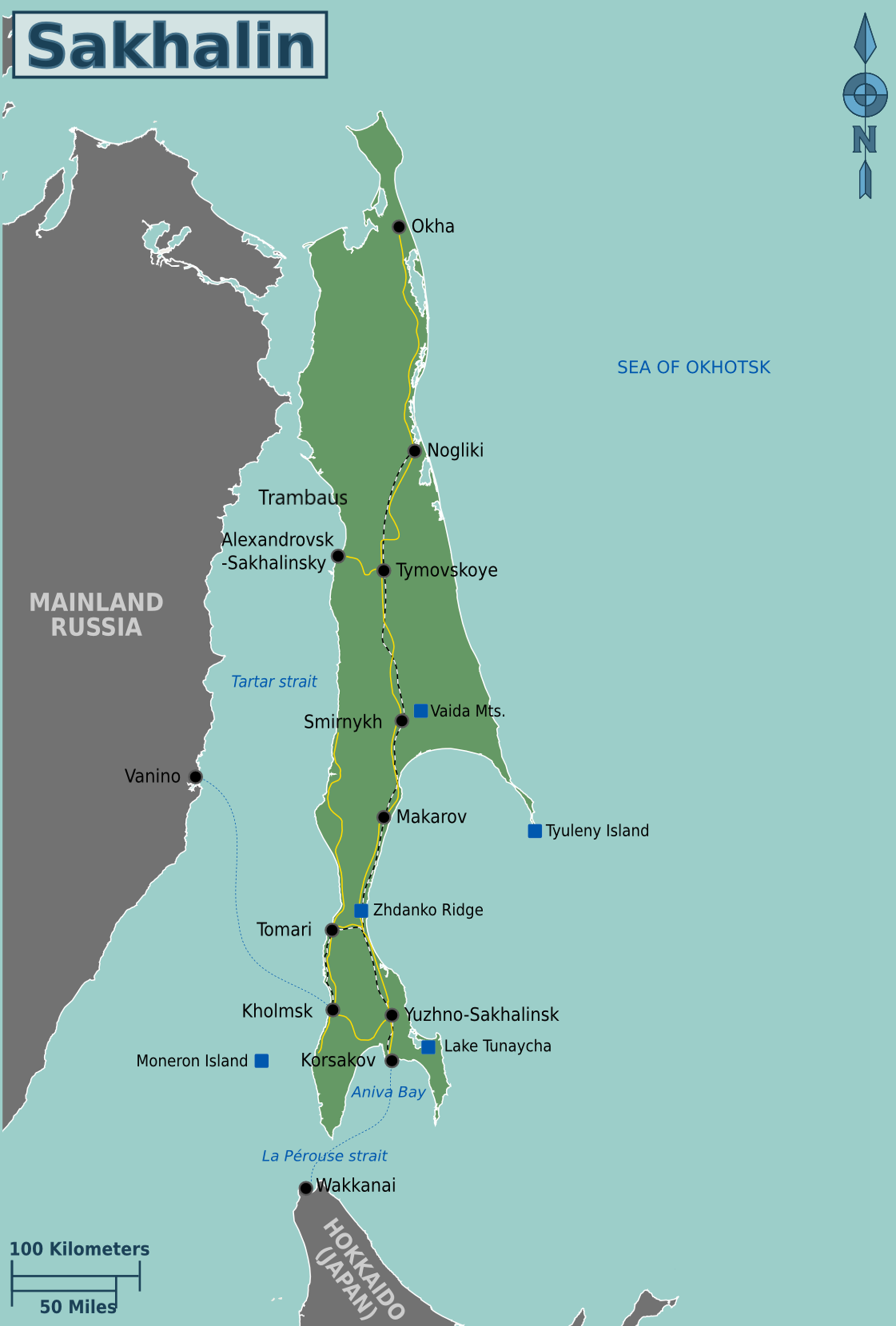
Map 1. The map of Sakhalin Island (source: File:Sakhalin map.svg. Wikimedia Commons).

Photo 1. The ruins of a Soviet collective farm. Aleksandrovks-Sakhalinskiy, 2016. Photographed by N. Mamontova.
It is not easy to get to Trambaus. One needs to take a dusty and constantly breaking bus, irregularly commuting from Aleksandrovsk-Sakhalinskiy to the settlement. In their development strategy, released in 2007, the Ministry of Industry and Energy and Institute for Energy Strategy, proclaims the development of new oil field sites in the Sea of Okhotsk and further gasification of the settlements. Yet, the latter has never been introduced in Trambaus, as well as in many other remote settlements on Sakhalin and elsewhere, which are not directly impacted by gas and oil development. In 2016, when I did my field research, there was no mains electricity and people still used petrol driven generators just for a few hours a day. All essential facilities including a school, a grocery shop and a post office had long been closed in Trambaus. The inhabitants took rides to the nearest Indigenous Evenki settlement of Viakhtu, 14 km away, to buy food, collect parcels and bring their children to school. Despite all the difficulties, people were ready to resist to the relocation plan, which the local authorities had been discussing for several years.
In the absence of oil and gas facilities nearby Trambaus, people appear to enjoy more freedom in access to fishing resources and less pressure from state-owned controlling bodies. Their isolation from infostructure and a remote geographical location makes the local knowledge of weather, ice and climate, in general, are crucial for people’s survival and well-being. In addition to such traditional forms of weather knowledge and forecast as observations and experience, they use weather diaries, daily weather records, which some community members have been keeping for years. These weather records are the document that narrates about daily weather patterns and natural hazards and reflects the decision-making process regarding access to marine resources in the community, namely salmon and navaga fisheries. In this paper, I explore one of such diaries as a source of community-based weather and ice knowledge. I argue that such diaries are more than just “hybrid forms of rural knowledge” as they are sometimes narrowly identified in the literature (e.g. Rakhmanova, Reference Rakhmanova2019), but the valuable source of information about weather, and when combined with interviews and ethnographic participatory observation, can tell us a lot about climate and other environmental changes in the historical perspective.
Background: On the relations between fishing rights, marine resources and weather
This section discusses the relations between the weather, the rural knowledge of the ice and the access to marine resources. The native population of Sakhalin is primarily involved in salmon and other fisheries. Salmon have long been utilised for subsistence use by the Indigenous population of the Pacific area, including Sakhalin, from time immemorial. The routes and specifics of migration of pink (Oncorhynchus gorbuscha) and chum (Oncorhynchus keta) salmon facilitated the development of the common features in cultures and subsistence activities of the Indigenous communities living in proximity to the Sea of Okhotsk (see Schrenck, Reference Schrenck1899). Most of the local population is still involved in this activity, either professionally or for everyday subsistence. The key reason for people’s denial to move out from Trambaus was access to valuable fish resources and the ability to participate in fishing subsistence activities more flexibly, without being constantly controlled by the regional Fisheries Inspectorate.
Salmon fisheries are strictly regulated in Sakhalin by the authorities due to the great demand and commercial value of salmon roe. Fishermen have to keep records about fish species they catch, capture locations, the type of fishing gear and vessel. Indigenous people are allowed to use gillnets in rivers and harvest a limited number of salmon for their own consumption without any permit. In Trambaus, this right is especially beneficial for Nivkh, the fishing and marine mammal hunting Indigenous community, which members constitute approximately 45% of the population in the settlement (Census, 2002). Some of them have the so-called clan-based communities (rodovaya obshchina), small-scaled non-profit fishing artels. The name rodovaya obshchina reflects the legacy of the Soviet nationality policy, according to which all Indigenous peoples were believed to have clans as the earliest form of their social organisation (see Pika, Reference Pika1999). The name is still in use in the Russian legislation regulating Indigenous people’s access to their traditional territories and resources (FL, 2000). The official status allows obshchina’s members to use more advanced fishing gear and allocated salmon quotas, but they still have no right to engage in commercial activities. There are only a few Indigenous commercial fishing enterprises in Sakhalin, none of which are in Trambaus (see Thornton & Mamontova, 2017; on Sakhalin fisheries, see also Simonova & Davydov, Reference Simonova and Davydov2014; Wilson, Reference Wilson and Kasten2002).
Obshchinas can also incorporate non-Indigenous members into their fishing alliances that further tightens social connections and co-dependence. Still, the relationships between Indigenous and Russian fishermen vary across the island (Mamontova, 2012). There is more tension on the eastern coast and in the south of the island where huge private fishing enterprises operate as they attract poachers and seasonal migrants, “outsiders” in the eyes of the local people. In contrast, Trambaus inhabitants always point out that they make no difference between ethnicities as their community is very small and most of the families have long been mixed. Another difference between the costs concerns the absence of development programmes for Indigenous people run by oil companies. Yet, this is also the reason for the infrastructure decay in the settlement.
In Trambaus, the relationships between fishermen can be defined in terms of traditional subsistence ethics based on reciprocity (cf. Scott, Reference Scott1976). The fishermen are supposed to share their harvests with relatives, elders, unemployed people and guests. This custom, which is called angstund in Nivkh (Kreinovich, Reference Kreinovich1973) and translated as “treat”, is observed by all community members despite their ethnic origins. Most of the seal meat – especially of the first caught animal – should be also given away without expecting to get anything in return. Through this custom, called uskraid or uskursh in Nivkh, people get access to valuable marine resources, which is particularly helpful in the absence of commercial quotas and jobs in the settlement.
Irregular salmon harvests constitute a significant problem on Sakhalin affecting human well-being in Trambaus. Research suggests that the current catastrophic decline in salmon production can be traced back to the long-term and poorly regulated exploitation of marine resources in the waters of the Far East by Japan and Soviet Russia in the previous century. This affected an inflexible kolkhoz (collective farm) economic system, which was completely dependent on state subsidies. The increased tariffs on fish transportation by rail from the Russia’s part of the Pacific Ocean to other regions in the late 1980s led to the further reduction of catches. The number of fishing vessels decreased by 21%. Many employees involved in the fishing industry lost their jobs and had to illegally harvest fish and sell it on the black market (Rimskaya, Reference Rimskaya2004). Starting from 1980 on, the share of unreported salmon harvests had been growing slowly until the collapse of the Soviet Union. Sakhalin poachers predominantly utilised pink salmon for caviar. When the state stopped subsidising food and transportation costs, the level of poaching almost tripled. In 1991, about 58% of salmon were cough illegally in Sakhalin, and this percentage remained high until 2010 (Sobolevskaya & Divovich, Reference Sobolevskaya and Divovich2015, p. 8; see also Beamesderfer, Tabunkof & Trumble, Reference Beamesderfer, Tabunkof and Trumble2012). The absence of commercial quotas on the one hand and the existence of the black market on the other hand forced Indigenous and other local inhabitants to engage in illegal activities to keep an average level of subsistence (for details, see Thornton & Mamontova, 2017).
The problem of shade economy became particularly urgent in 2007 after some crucial amendments to the Russian legislation regulating Indigenous fisheries were passed. Many Indigenous fishermen were not aware of the newly introduced changes and failed to reregister their fishing sites. As a result, they lost the sites along with access to commercial fisheries. Without the commercial quota and the registered fishing site, community members cannot claim for compensation in case of natural hazards. In Trambaus, the most dangerous natural event, affecting people’s lives, is “drifting ice”. The fishermen say that its behaviour has become unpredictable due to climate change induced by oil and gas mass exploitations involving marine explosions and seismic examinations (see Fig. 1). They pointed out an increase in precipitation and the frequency of strong and stormy winds in the winter period, which makes the ice unpredictable. Warmer winters are further affecting the permafrost thawing in the southern part of the Far East’s region and can lead to an increase in precipitation and the sea level. For the community members, who are dependent on ice fishing, it can further lead to the inability to supply their families with food in the winter period. The weather diary from Trambaus reflects the ice’s behaviour and documents such unfavourable events as drifting and detached ice sheets, blizzards and hurricanes. It also shows the relations between these events and subsistence activities. The following section provides an account of the diary’s structure and data.

Fig. 1. Average annual temperatures in Sakhalin, 1947–2020 (based on the data provided by pogodaiklimat.ru).
Weather diary from Trambaus: Structure and data
The initial idea of my research was to collect data about the local subsistence practices and compare it with similar data I gathered in 2009 and 2013 in other Sakhalin settlements (Nogliki and Nekrasovka). However, I realised quite soon that I had to expand my research by examining human–weather relations as this issue was constantly arising in my interviews with the local residents. The weather diary that is in the focus of this research has been kept by Anna Malyanina, a Russian woman and a retired postman, from the year 2000 onwards. The diary was shown to me with the permission by her son Vladislav, a fisherman, who also generously shared his knowledge on different aspects of fisheries, helped me to arrange interviews with other Trambaus residents, and provided me with the photographs of the ice (see Photo 5). Unfortunately, during my fieldwork, I was not being able to make a full copy of the diary due to a technical issue. Vladislav kindly posted the diary to me along with dried salmon later in the same year. I made a copy of the diary and sent it back to Trambaus accompanied by Christmas presents.
This diary is typical in terms of its structure and its prototypes can be found in most of the rural areas across Russia (cf. Rakhmanova, Reference Rakhmanova2019). All the entries are arranged in a table with a few columns. Some comments are made on the margins. For example, the diary keeper highlights the days with unusual or catastrophic events, including natural ones that happened not only in the settlement but also somewhere else, climate proxies and icebreaking. It also contains records regarding the local flora and fauna, domestic and wild animals, dreams and life in the community in general. Most of the records concern daily temperatures, precipitation and wind. The descriptions are accurate, short and direct, which makes them easy to analyse (see Photo 2). The diary also includes recollections of such activities as trips to the regional centre, births and deaths and visits from family and friends. Only a few days each year and one entire month in 2015 have no entries due to the woman’s illness or absence in Trambaus.

Photo 2. The diary. Photographed by N. Mamontova, 2016.
The language of the diary is Russian. The diary keeper uses both scholarly and common terms to describe weather and ice. For example, along with the more scientific term of tsiklon “cyclone”, there are such ordinary generic terms as sneg “snow”, tuman “fog”, dozhd’ “rain” and others. She also uses descriptive terms as in mokriy sneg “wet snow” or slyakot’ for sleet, uraganniy veter “hurricane wind” for gale, which she differs from “strong wind,” silniy dozhd’ for heavy rain and so forth. The term buran “blizzard”, which is originally a Turkic loan word, referring to a severe snowstorm with high winds and a temperature below 0°C can be considered as local, as it is not normally used in weather scientific nomenclature (see Belyaeva, Reference Belyaeva and Krylova2019). Other similar Russian terms for a snowstorm, such as purga, viyuga and metel’, are not used in the diary at all. Neither the diary keeper utilises Nivkh terms (on the uniqueness of Indigenous snow and ice terminologies, see, e.g. Grenoble Reference Grenoble2011; Krupnik, Reference Krupnik2011; Magga Reference Magga2006).
The precipitation entries include the days that were “sunny” (solnechno), “sunny intervals” (peremennaya oblachnost), “foggy” (tuman), “cloudy” (oblachno), “snowy” (sneg), “with heavy snow” (silniy sneg), “with blizzard” (buran), “rainy” (dozhd’), “with heavy rain” (silniy dozhd’) and some others. Despite their simplicity, these entries allow us to figure out the number of rainy and foggy days in each year, and then compare the numbers over a period of time (see Table 1). For example, the year 2004 was predominantly sunny (189 sunny days). There were 55 cloudy and 48 rainy days, respectively. Only one day is marked as “foggy”. This information is essential for some annual subsistence activities related to fisheries. Summer is a good time to process and store chum and pink salmon and caviar for the rest of the year (see Photo 3). People dry salmon carcasses on the seaside, in the sun, by hanging them on wooden poles. The marine air makes salmon naturally salty, whereas the sun dries it out. If the weather is humid, rainy or foggy for a prolonged period of time, the salmon cannot be processed well because of the great number of insects spoiling the meat and the lack of sunshine. The same is true of gathering wild berries and herbs. Unusually, foggy summers have also been mentioned in my interviews with the local residents in other parts of Sakhalin,
If the cloudberries have bloomed and the fog has fallen, then we know for sure that there will be no cloudberries. Everything will be beaten (pobito) by the fog. The winters are very cold and there is little snow. In summer, the temperature reaches 40 degrees. It seems to me that these are the consequences of forest fires (Anzhela Osipova, Nivkh, Nogliki settlement, recorded by N. Mamontova, 2013).

Photo 3. Summer collective fishing near Trambaus. Photographed by N. Mamontova, 2016.
Table 1. The number of documented natural phenomena in 2004 according to seasons (based on the weather diary).

Thus, the diary keeper describes July 2004 as “very bad due to heavy rains and lack of sunshine.” There were 10 cloudy and 6 rainy days, and the average daily temperature did not exceed + 18° C (the temperature is measured with a traditional outdoor thermometer hanging outside by the kitchen window so that to check the temperature indoors). In the absence of electricity and refrigerators, well-dried salmon and caviar form the basis of subsistence, providing not only humans but also their dogs with food until the next fishing season. Hence, the duration of sunshine, the quality of the wind and the level of humidity are crucial in this complex process of reciprocal relations and communal actions that characterise the daily life in the settlement.
The wind section describes the intensity and duration of the wind during the day. The entries include such records as slabiy veter “light wind” or “breeze”, sredniy veter “moderate wind”, silniy veter “strong wind”, uraganniy veter “hurricane wind”, shtorm “storm”, uragan “hurricane”, buran “blizzard” for a severe snowstorm with high winds. Clarification of the differences between these wind types is difficult because they are based on experience rather than measurement. In 2004, there were 158 quiet days, with no wind reported; 45 days are marked with “moderate wind”, 30 days have “strong wind” entries and 19 blizzards and 3 hurricanes are reported. It appears essential that the diary keeper reports on wind mainly in the winter period (November–March). In particular, the correlation between the intensity of wind and ice behaviour is highlighted. Some types of wind are specified in the diary: a south wind bringing storms and a chilly east wind. The information of the wind direction and intensity is used to predict the behaviour of the ice during the winter fishing season when people harvest fish in the open sea using ice sheets as natural platforms. Stormy weather in the late autumn and in the springtime may distract fishermen from harvesting.
Summer brings other difficulties. As said above, Indigenous fishermen and their family members use fishing quotas for personal consumption. Obshchinas can also collect quotas of those community members who are unable to harvest fish by themselves due to the age or the lack of equipment. After the fishing season is over, the fishermen are supposed to bring their catches back and distribute them amongst the members which quotas they have used. Normally, these quotas are valid within a limited period of time. Since there is no population of chum salmon near Trambaus, the fishermen catch this species in another Nivkh settlement, Chi-Unvd, located in the neighbouring Tymovsk district. Hence, during a short summer, they have to drive to a distant fishing site, catch enough fish to distribute in the community and process for their own consumption, as well as to store for their family members and dogs to feed on during a long winter. It is evident that a good weather plays a leading role in these activities. Weather diaries can be used to predict the most favourable dates for fishing activities in order to discuss them with the local authorities.
In the winter period, people are involved in navaga (Eleginus gracilis) fisheries. Research conducted in the Nivkh settlements of Nekrasovka and Nogliki in 2009 shows that the consumption of non-salmon fish, mainly smelt fish and navaga, constituted around 63 kg per capita (324 per household) and 257 kg per capita (497 per HH), respectively, (see Thornton & Mamontova, 2017). The figures are much higher for obshchinas. In winter, navaga sprawls in nearshore waters where community members fish it with special traps (see Photo 4). The traps are set below the ice in shallow waters and check regularly. The ice should remain persistent throughout the fishing season to provide safe access to the sprawling grounds. Each fisherman keeps a “fishing diary” (rybolovniy dnevnik), which records the daily catches to report the results back to the authorities. This measure is required to prevent overfishing and underreporting. Fishing diaries or journals allow fishermen to determine the amount and dynamic of fish harvests according to species for different years. The access to such diaries is not usually a problem, as they contain official information regarding catches and fishing gear that can be shared with both official bodies and researchers.

Photo 4. Navaga fishing traps. Photographed by N. Mamontova, Trambaus, 2016.
According to one of the fishing journals from Trambaus (provided by Nivkh fishing obshchina “Vo”), in January 2016, an obshchina caught on average 100–150 kg of navaga daily. The total navaga harvest for the period from 22 January to 10 February constituted 4300 kg. The journal’s last entry reports on the ice break and the loss of all three fishing traps along with fish. The weather diary similarly points out that “the ice has gone” on that day. Such an insignificant even at the global scale as “breaking ice” near Trambaus turned out to be of high importance for the local community due to the chain of reciprocal relations discussed above. The head of the obshchina did not only lose his valuable fishing traps, but also became enable to provide other community members with fish. Fortunately for him, this accident happened in February when the fishing season was coming to its end.
To conclude, considering the importance of the ice and weather for the community members’ well-being, people constantly engage in face-to-face “weather talks” and exchange information about weather patterns and the ice’s behvaiour in different places along the seashore. In the absence of phone coverage, this information helps fishermen to choose an appropriate fishing site and to make a correct decision concerning safety on the ice and during open sea fishing. They usually, but not exclusively, participate in such conversations before and after fishing. The comments on the sea ice in the diary are mainly based on oral information and observations made by fishermen (cf. with Inuit ice experts in Aporta, Reference Aporta2011). During my interviews with the informants, both in Trambaus and other surveyed Sakhalin settlements, people constantly drove my attention to the changing weather patterns and how this fact affects their subsistence activities. Official weather forecasts are not able to predict the local weather accurately and advise people on the ice patterns near their settlements. Yet, the issue of safety is crucial as the ice provides people not only with food but also with navigation routes. The frozen Tatar Strait serves as a natural bridge during the wintertime, through which people travel by snowmobiles to the mainland, as well as to the neighbouring settlements situated along the coast. The ice literally brings together different aspects of human life in Trambaus and makes it possible for people to establish their relations with other beings and places. The next section discusses these complex relations between the ice, humans and other environmental agents in more detail.
On the relations between sea ice, wind, fish and people
Research (Enomoto, Kumano, Kimura, Tateyama & Uratskuka, Reference Enomoto, Kumano, Kimura, Tateyama and Uratskuka2013) shows that there are highly variable ice drifting patterns along the coast of Sakhalin that makes it difficult to predict its behaviour even for scientists with all their sophisticated measurement equipment. The inhabitants of Trambaus are aware of this fact from their experience of regularly dealing with the ice. They compare the condition of the ice in different places to choose the best site for winter fisheries. For example, the ice may “stand,” as they say, at the place of “the old settlement” (the place where Trambaus was initially established, located 3 km away on the river of Trambaus) but has already gone in Trambaus. People follow the ice drifting patterns and constantly adjust themselves to the evolving situation here and now. As the interviewed residents reported, over the past decade due to the warming temperatures in the Sea of Okhotsk, the ice has become more unstable. For Trambaus fishermen, this fact makes their relationships with the ice more intricate as they risk their lives going out to fish on the ice platform. Thus, in January 2020, almost 500 fishermen became trapped on a sheet of floating ice that broke off in the south of Sakhalin. The weather diary reports similar cases happened near Trambaus as the result of the sudden ice break or its drift. In addition to the diary, the photographs of the ice serve as another valuable source of information regarding its condition. Amongst the photographs I received from Vladislav, for “my work” as he said, there were pictures of the sea ice, snowdrifts, icicles and winter roads (zimnik) across the Tatar Strait (see Photo 5). They were not taken for this research but rather shared with me, suggesting his long-term interest in snow and ice.

Photo 5. The temporalities of the ice. Photographed by Vladislav Sinyoga, Trambaus, received by N. Mamontova in 2016.
Drifting, thin or unstable ice is a major problem people have to deal with from January to April. The condition of the ice varies not only from one year to the next, but can also change several times even within a month. For example, during winter 2003–2004, as the diary reports, the ice was rather stable. The first sea ice was established near Trambaus on 27 December and was persistent throughout January 2004. The average temperatures were −14° and −15° C, respectively. The weather was calm with no wind reported. First navaga was harvested and shared on 29 December. The ice edge (kromka) was torn apart by the moderate wind on 22 January, but the ice remained solid until 3 February. It again came back in mid-February by allowing the people to spend more time fishing on the ice platform. Subsequent to February, the presence of the ice was reported only by the fishermen harvesting near the “old settlement”. On 10 March, on the first windy day in a long time, the ice drifted away. December 2004 records no entries on the ice, and neither did the fishing season start. Some ice was noticed on 4 January. It finally arrived in Trambaus on 6 January 2005 to stay for a few days. On 8 January, a strong wind carried away one of the fishing traps. The weather continued to worsen and resulted in a week-long blizzard (buran). As a result, the ice detached from the shore and floated away. On 26 January, the ice returned and stayed persistent near Trambaus. On 30 January, the diary reports the presence of the ice in both Trambaus and the old settlement. The average temperatures were −22°C by day and −31°C by night. However, warm temperatures during the first week of February (−10°-13°C) and strong offshore winds again drove the ice away. On 14 February, the diary reports the process of ice formation. A few days after it became solid, the fishermen were allowed to go out on the ice platform. From 21 to 24 February, another blizzard carried the ice away. The diary concludes, “there was no ice in February, much snow”. On 15 March, the diary reports the formation of “thin ice” (tonkiy lyod) near Trambaus, and this is the final entry regarding the ice. March is described as “very bad; much snow, the ice has not stayed, cold.” In addition to these observations, we also get to know that a new road was built and a cow calved. The following table summarises ice observations presented above (see Table 2):
A phenomenological observation of weather and ice conditions can substantially differ from how the condition of sea ice is presented and discussed in scientific reports. Let us compare a report made in 2013 by the Sakhalin Scientific Research Institute of Fisheries and Oceanography, known as SakhNIRO, with the weather diary regarding sea ice in the Tatar Strait. This comparison allows us to better understand what kind of information appears to be more relevant for the community members.
According to SakhNIRO, in March 2013, the ice covered more than 1,000 000 sqm, which was almost 70,000 sqm less than in the previous year. The process of ice melting in the Okhotsk Sea began in April. The area covered by the ice decreased to 650 000 sqm, which was almost 200 000 sqm less than a year before. At the same time, negative temperatures remained in most areas free from ice. The water temperature on the surface was –1.3°C lower than average. This indicator reached its minimum over 17 years of satellite observations. In May, the Tatar Strait became completely free from ice. The surface waters in the strait were characterised by slow heating. Yet, the water temperature in the north of the strait did not exceed + 2°C, whereas in the south, this indicator ranged from +2° to +6°C. Negative anomalies of water temperatures, up to 2°–4°C, were observed along the whole coastline (see http://www.sakhniro.ru/page/satellite_info/).
The weather diary reports that in March 2013, there were two hurricanes and four blizzards with gales and heavy snow. The sea ice drifted away on 29 March following a blizzard. In comparison, in 2012, the ice floated away on 4 April after a hurricane and a storm. In 2003, the last entry regarding the ice was recorded on 17 April and after that during the following seven consecutive years, the ice did not persist after mid-March (see Table 3 on the data concerning the end of fishing season in the period from 2000 to 2016). In practice, it suggests the shortening of the ice fishing season and the reduction of catches. This information is neglected by the Fisheries Inspectorate when assigning dates for fishing seasons.
Table 2. Weather and ice observations during two winter ice fishing seasons (2003–2005).

Table 3. The number of blizzards, hurricanes, strong winds and last entry regarding the condition of the ice between 2000 and 2016 (based on the weather diary).

The data from the diary demonstrates that there is a relation between the number and intensity of blizzards in the period from January to mid-April and ice drifting. The more blizzards there are, the more unstable the ice is and the more likely it drifts away earlier (cf. with scientific data in Pishchal’nik et al., Reference Pishchal’nik, Minervin and Romanyuk2017; cf. with Inuit observations in Taverniers, Reference Taverniers, Krupnik, Aporta, Gearheard, Laidler and Holm2010, p. 45). After each blizzard, the diary reports whether the ice is still “standing” (lyod stoit) or “has gone.” According to the records, the most favourable year was 2007. The ice persisted throughout January and February, which allowed people to spend more time fishing in the sea. The diary keeper concludes, “January is good. The ice was stable throughout the whole month. It was torn away only once.” In contrast, a year before is characterised as follows, “January was bad. Blizzards and no ice.”
The year 2007 was also a record year for some fish species reproduction (Kaev, Reference Kaev2018, p. 7). For example, pink salmon stocks are significantly affected by typhoons during their embryonic development in sprawling rivers and whilst feeding juveniles in the coastal waters after downstream migrations. The extreme natural events appear to be one of the key factors regulating salmon reproduction in Sakhalin. It suggests that ice actions affect not only people, but also fish species and the marine environment in general. For example, sea ice is important for migratory birds to rest on during their long journeys across the sea. The diary reports on migratory birds and documents the first dates of their appearance annually. Yet, sometimes, the quality of the ice is considered as good, but fish do not come anyway as it happened in 2011. Some interviewed residents explain the fish decline for several reasons. Nivkh fisherman Dmitry Kafkan summarises these reasons as follows:
We used to fish all year round. In the spring the ice was carried away, and in the autumn it again formed. We caught everything: smelt fish, pink salmon, char, and herring. In winter, we caught navaga. Yet in recent years, fish have disappeared altogether. [This decline] has started from the time of perestroika on. In the Tatar Strait, both foreign vessels and ours began to scoop everything out (vygrebli). The food supply was destroyed <…>. There is less plankton, and plankton is the basis of everything. It is like a chain, with every element connected to each other.
He links the poor quality of the ice with the activity of the ice breaker in the Tatar Strait, which clears the way to the oil refining factory in Khabarovsk, and ecological changes:
Our line of the solid ice used to start below Aleksandrovsk, nearby Pilvo settlement. And now there is practically no solid ice at all. In winter, we fish [on the ice platform], set fish traps… A light gust of wind and here we are, the ice is carried away. It has happened that people were carried away along with the ice, as well as fishing gear and snowmobiles (Dmitry Kafkan, Trambaus, recorded by N. Mamontova, 2016).
The following table shows the number of blizzards, hurricanes and strong winds in the period between 2000 and 2016 as reported by the weather diary. It also identifies the number of entries concerning the ice, the date of the last entry about the ice, which is also the end of ice fishing, and related comments.
Returning to the technical report, as the comparison shows, whether weather science technical reports discuss data concerning the size of an ice sheet, the water and surface temperatures and other quantitative parameters, the weather diary contains observations about the ice behaviour in its relation to people’s subsistence activities and other beings. The ice can move around different places, come and go, be stable and mature or thin and young. The ice can also be “standing” (lit.: lyod stoit) or being in the process of formation (lit.: lyod stanovitsya). It may crack and drift away. It happens that the ice takes people along or damages their fishing traps. Normally, the diary keeper describes the ice by using the active voice. The only passive construction is used when the relations between the ice and the wind are concerned: “the ice is torn apart”, “the ice was carried away”, “the ice was driven back and forth (by the wind)”. The entries reporting on the ice’s behaviour are accompanied by information on the appearance or disappearance of fish species and birds, descriptions of fisheries and fish distribution, natural hazards and human activities on the ice. In contrast to technical reports, these are the complex interconnects between environmental agents, which are the focus of the weather diary rather than generalised parameters.
Other differences between these two forms of reporting concern scale and timeframe. As H. Eicken (Reference Eicken, Krupnik, Aporta, Gearheard, Laidler and Holm2010, p. 359), points out satellite images used in scientific research to evaluate and monitor ice movement normally show macro-processes, whereas Indigenous and other local experts may be interested in making more detailed and place-relevant observations that are related to their “multifaceted perspective on sea ice as both a material and a process”. Thus, the diary keeper compares the condition of the ice in three sites near Trambaus, located not far from each other. This information is barely visible on a satellite image because of its small size (see Fig. 2). Despite their proximity to each other, ice patterns, as the diary reports, can be fundamentally different at these sites. Yet, even small variations in ice behaviour can either facilitate or prohibit fishing and navigation. Additionally, the ice patterns can change weekly. In this regard, the diary allows us to reconstruct the history of the sea ice vis-à-vis place, time, and human activities on the ice. This statement further suggests that in the development of fisheries regulations, community-based weather and ice observations should be considered as relevant as state-provided official forecasts.

Fig. 2. Satellite image of the ice condition in the Okhotsk Sea (as of 8–12 December 2020) (source: meteorf.ru).
Conclusion: Integrating vernacular meteorology into research on local weather patterns and climate change
This paper shows that vernacular or rural weather diaries can serve as a good source of information on the links between the weather, natural events, multiple beings, including fish and dogs, subsistence practices and local inhabitants. Research reveals that Trambaus fishermen rely heavily on non-human environmental agents, which can provide them with access to marine resources or leave them with nothing until the next fishing season. The diary provides insight into the essence of these complex relationships and their changes in the long-term perspective. As a live history record, the diary demonstrates that such natural events as hurricanes and blizzards are perceived by the local inhabitants as directly related to human activities and the ice drifting patterns.
Amongst all the records reporting on wind, temperatures and precipitation, the ice occupies a special place in the diary that reflects its leading role in subsistence, prosperity, navigation and safety amongst the local community of fishermen, both Indigenous Nivkh and Russians. Long winters make the ice the key element of the environmental chain uniting humans with other species and different environmental agents. The ice is recognised as an environmental force making a significant impact on the well-being in the settlement as people and their dogs are dependent on winter fisheries. People constantly learn about the changing behaviour and drifting patterns of the ice, as well as its interactions with other natural phenomena. Scientific research does not normally consider these durable yet nuanced interconnections between the ice, the wind, the fish and people living in close proximity to the sea. This paper argues that these interconnections are essential for understanding human activities and attachments to the place. It is the ice that constitutes the genius loci of the place preventing people from moving out from Trambaus.
Over the past decade, there have been numerous changes in the environment related to climate. At the local level, these changes have resulted in the uncertainty amongst local people concerning the ice’s behaviour and the future of winter fisheries. They have noticed that the ice goes away earlier and earlier that shortens the duration of winter fisheries. It has also become more unpredictable and less persistent. Considering the importance of local ice and weather knowledge in Trambaus and other Sakhalin settlements, this paper calls for integrating local knowledge about the weather and environmental relations into both research and policy on climate change and resource use. In this regard, weather diaries and other community-based records can be considered as a significant source of data, providing community members and researchers with long-term qualitative and quantitative observations.
These observations, in turn, can be used to inform local forecasts and fisheries management. At the moment, the latter does not take into consideration the localised relations between the ice patterns and subsistence practices, as well as the interconnections between different environmental forces and their impact on community well-being and livelihood. In regard to fisheries policy, this neglect results, for example, in the discrepancy between the dates allocated by the authorities for subsistence fishing and the real weather and ice conditions, which may not be favourable for the safe conduct of these practices. Along with numerous restrictions limiting commercial activities, the ignorance of local knowledge, including that of ice and weather, further leads to the fact that many subsistence activities are carried out illegitimately and even illegally, in a grey zone, where people feel more freedom to do things in their own way and according to their understanding of the local conditions. Yet, in a long-term perspective, it is risky, potentially dangerous and unsustainable. Hence, the integration of the local knowledge into the fisheries management and policies can partly resolve this problem, which is beneficial for both the government regulatory bodies and residents.
Acknowledgements
The work on this paper was supported by the project “Anthropology of Extractivism: Research and Design of Social Changes in the Regions with Resource-Based Economy” (RSCF, grant No. 20-68-46043, PI Professor D.A. Funk). I would like to thank Anna Mitrofanovna Malyanina (1937–2016), who sadly passed away shortly after my fieldwork, for allowing me to make a copy of her weather diary. Without her valuable meteorological observations and generosity this research would not have been possible. I also thank her son Vladislav Sinyoga for his help and hospitality during my fieldwork, as well as for having provided me with photographs for my research. I am grateful to Dewi Pobydd for consulting me on my English. I would also like to acknowledge the engagement and valuable comments provided by the two anonymous referees who helped me to significantly improve my research.


