


Introduction
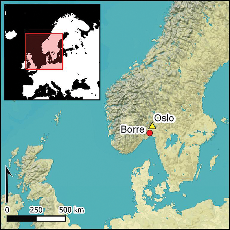
The site of Borre in Norway has captivated historians and archaeologists since the eighteenth century (Figure 1; Nicolaysen Reference Nicolaysen1854; Brøgger Reference Brøgger1916; Blindheim Reference Blindheim and Lillevold1954; Myhre Reference Myhre, Mikkelsen and Larsen1992, Reference Myhre2015; Østigård & Gansum Reference Østigård, Gansum, Edquist, Hermansson and Johansen2009). Borre features one of the largest concentrations of Late Nordic Iron and Viking Ages (AD 400–800 and 800–1050 respectively) monumental funerary structures in Scandinavia, comprising nine burial mounds (two of which no longer survive), three cairns and over 40 other burial structures. Consequently, the site has been interpreted as a royal cemetery (Østigård & Gansum Reference Østigård, Gansum, Edquist, Hermansson and Johansen2009: 251; Myhre Reference Myhre2015).

Figure 1. Location of Borre on the western coast of the Oslofjord in Norway, along with other well-known Iron Age sites (background map: national elevation model, Kartverket (Norwegian Mapping Authority 2019; www.høydedata.no); © Vestfold fylkeskommune, figure created by Erich Nau).
In 2007 and 2008, ground-penetrating radar (GPR) surveys on arable land surrounding the monuments revealed traces of two large buildings (Trinks Reference Trinks2007; Sala Reference Sala2008)—the first evidence of such structures at Borre. In 2013, additional large-scale, high-resolution GPR surveys targeting the landscape around the cemetery area were conducted by the Ludwig Boltzmann Institute for Archaeological Prospection and Virtual Archaeology in Vienna, the Norwegian Institute for Cultural Heritage Research and the Department for Cultural Heritage Management of Vestfold County Council. These surveys revealed a third building with dimensions exceeding those of the two structures detected in 2007. The unusual size and layout of the three buildings compared to ordinary longhouses raises questions regarding their role and function. Could these buildings represent the halls from Nordic myths known to be connected to prominent sites such as Borre?
This article is the first publication of these new discoveries. We describe how these buildings were detected, characterise their layout in detail and then discuss the differences between Scandinavian longhouses and halls, including the question of where the Borre buildings may fit within these categories. Finally, we provide a preliminary chronological framework for the buildings within the archaeological context of Borre.
The Late Iron and Viking Age site of Borre
Borre is located in Horten municipality, Vestfold County, Norway. The site lies on gently sloping terrain extending from the ridge of the terminal Ra moraine in the north-west down to the current shoreline bordering the Oslofjord in the south-east (Figures 1–2). Although best known for its monumental burial mounds and cairns measuring up to 47m in diameter and 7m in height, Borre also accommodates over 40 smaller burial structures (Myhre Reference Myhre2015).

Figure 2. The site of Borre showing the mound cemetery and the newly discovered buildings A, B and C (see also Draganits et al. Reference Draganits, Doneus, Gansum, Gustavsen, Nau, Tonning and Trinks2015: 106, fig. 10). Note the shifted position of the shoreline around AD 800 (Sørensen et al. Reference Sørensen, Henningsmoen, Høeg, Stabell, Bukholm and Skre2007) (background map: Kartverket (Norwegian Mapping Authority 2019; www.høydedata.no); © Vestfold fylkeskommune, figure created by Erich Nau).
Borre's uniqueness and significance in Scandinavian archaeology have attracted a plethora of mainly small-scale research excavations over the last 150 years. In 1852, the remains of a Viking Age ship burial were discovered by workers of the Norwegian road authorities and partially documented by Nicolay Nicolaysen (Nicolaysen Reference Nicolaysen1854: 29; Myhre & Gansum Reference Myhre and Gansum2003: 38–39). The mound associated with the ship contained richly decorated riding equipment, including gilded harnesses and ornate saddle fragments. These are known collectively as the Borre finds, which today give their name to the ‘Borre style’ of ornamentation (Myhre Reference Myhre2015: 4–5 & 44–54). Further archaeological excavations and surveys were conducted in 1927 and 1979 (Grieg Reference Grieg1943; Myhre & Gansum Reference Myhre and Gansum2003), focusing on the cemetery area, as well as individual graves, burial mounds and associated grave goods. Between 1988 and 1992, the Borre Project, led by Bjørn Myhre, looked at the archaeological landscape from a more holistic perspective (Myhre Reference Myhre, Mikkelsen and Larsen1992, Reference Myhre2015; Jerpåsen Reference Jerpåsen and Bjerva1993). This project provided radiocarbon dates (Myhre Reference Myhre2015: 90 & 93) for mounds 3 (average dating (2 samples) 770–890 cal AD at 68 per cent confidence (BP 1211±45)), 6 (average dating (2 samples) 620–720 cal AD at 68 per cent confidence (BP 1358±62)), 7 (average dating (4 samples) 580–690 cal AD at 68 per cent confidence (BP 1406±59)) and the ship mound (average dating (6 samples) 657–814 cal AD at 68 per cent confidence (BP 1283±41)). It also revealed the potential for the discovery of further structures in the fields surrounding the site (Myhre Reference Myhre2015: 90 & 93). A soil phosphate survey indicated the possible presence of buried structures, and subsequent excavation yielded postholes, cooking pits and a possible wall trench (Myhre Reference Myhre2015: 41). Although limited excavation at the time prevented these features from being interpreted as elements of a large building (Myhre Reference Myhre2015: 99), this was made clear in 2007 by GPR surveys conducted by the Swedish Central National Heritage Board (Trinks Reference Trinks2007). Between 2016 and 2017, buildings A and B were subjected to minimally invasive investigations, including repeated GPR surveys and small-scale excavations during the Borre Monitoring Project (Schneidhofer et al. Reference Schneidhofer, Jennings, Gaffney, Sparrow and Gaffney2017).
Methodology
As they are timber-built, Late Iron Age buildings usually survive in the archaeological record as patterns of postholes or traces of wall trenches (Herschend Reference Herschend2009: 253). These features are detectable by non-invasive archaeological prospection methods, which can provide replicable and detailed information concerning the surface and subsurface without destroying the archaeological features themselves, an important factor for investigations at highly protected sites such as Borre.
A series of high-resolution GPR surveys conducted at the site between 2007 and 2016 have provided a unique comparative dataset (Figure 3), which has been used for a detailed investigation of the buildings (Figure 4; see Table S1 in the online supplementary material (OSM)). Interpretative maps of the buildings have been prepared using specific tools developed by the Ludwig Boltzmann Institute for Archaeological Prospection and Virtual Archaeology within a geographic information system (GIS), based on georeferenced composite depth slices derived from the GPR data.

Figure 3. Overview of GPR surveys carried out at Borre since 2007 using different motorised and manual prospection systems (background map: Kartverket (the Norwegian Mapping Authority 2019; www.høydedata.no); © Vestfold fylkeskommune, figure created by Erich Nau).

Figure 4. The GPR datasets used for the interpretation of buildings A, B and C were acquired with different measurement devices (photographs © Vestfold Fylkeskommune, the Norsk Institutt for Kulturminneforskning and the Ludwig Boltzmann Institute for Archaeological Prospection and Virtual Archaeology).
Non-invasive prospection methods do not provide datable material or finds for typo-chronological analyses. We therefore applied a minimally invasive approach, in which interpretative maps inform the location of targeted small-scale excavations within buildings A and B that were designed to assess the accuracy of the GPR data interpretation and to retrieve material and finds for dating purposes.
Archaeological interpretation
Building A
The presence of a modern stone wall restricted the 2007 GPR survey of building A (Figure 5). Its original dimensions, including the part covered by the modern boundary, were approximately 40 × 12m; today, up to 35 × 12m of the occupation area is available for prospection. The terrain to the west and east of the modern wall, inside the Borre Park, forms a plateau that is interpreted here as part of a building platform.

Figure 5. a) GPR depth slice (0.30–0.80m below ground surface, inverted greyscale, i.e. darker colour corresponds to more absorbing feature) displaying the postholes of building A; b) interpretative mapping of the GPR data revealed at least two construction phases, as indicated by the layout of the roof-bearing posts. The two rectangles in the centre of the building indicate the location of the central open areas in phases 1 and 2 (© Vestfold fylkeskommune; figure created by Erich Nau & Petra Schneidhofer).
Building A includes 59 clearly identifiable postholes, visible in the GPR data from depths of ~0.25 to ~1.30m below ground surface (Figure 5a), with diameters ranging between 0.80m and 1.50m (Figure 5b). Twenty-five of these postholes are located in the central part of the building and interpreted as substantial roof-bearing posts, which are set more than 1m into the ground. Of these, 22 are paired in a formation called ‘trestles’ in Scandinavian archaeology. Two postholes—located in the northern part of the building—lack their peers, which have probably been covered by the modern stone boundary wall. Another posthole might have formed part of the northernmost pair, but the GPR data are inconclusive in this case. The sheer number of roof-bearing postholes and their proximity to each other—some are less than 0.60m apart—strongly suggest a two-phased building, although this interpretation requires verification. The outline of the phase 1 building seems to have been re-used in phase 2, with a slight shift in the position of the roof-bearing posts. The southern half of the building is delimited by timber slots, some of which have an internal series of small postholes with an average diameter of 0.34m. A similar set of features was recorded during the excavation of a hall in Gamla Uppsala and tentatively interpreted as a second outer wall (Ljungkvist & Frölund Reference Ljungkvist and Frölund2015: 16–17). Central open areas of around 44m2 have been identified between the respective fourth and fifth trestles (from the building's southern end) during both occupational phases.
An elongated feature located to the immediate north-west of the building—and slightly uphill from it—and measuring approximately 43 × 0.70m (Figure 5b) is interpreted as a possible drainage ditch for collecting rainwater from the roof and diverting surface run-off around the building. This is supported by the electromagnetic properties of the feature as observed in the GPR data, which point to a back-fill with fine-grained material.
Small-scale excavation in 1991 (Myhre Reference Myhre2015: 98) and the minimally invasive investigations during the Borre Monitoring Project (trench for S1: 1.30 × 1.80m; trench for S10: 2 × 2m) have shown that postholes S1 and probably S10 were re-used as cooking pits—a unique discovery in hall research. Three radiocarbon dates from charcoal in these pits overlying posthole S1 (Beta 481310: 545–645 cal AD at 95.4 per cent confidence (BP 1470±30), BetaCal3.9 using IntCal13 (Bronk Ramsey Reference Bronk Ramsey2009; Reimer et al. Reference Reimer2013)); T10242: 430–625 cal AD at 68 per cent confidence (BP1520±80) (Myhre Reference Myhre2015: 99) and S10 (Beta-481311: 662–778 cal AD at 95.4 per cent confidence (BP 1270±30)), BetaCal3.9 using IntCal13 (Bronk Ramsey Reference Bronk Ramsey2009; Reimer et al. Reference Reimer2013) provide a terminus ante quem for the end of building A, placing the structure firmly within the Late Nordic Iron Age.
Building B
The ephemeral nature of the features in the GPR data from building B made interpretation of this structure more challenging than for buildings A and C. Building B is situated on the same ridge as building A, approximately 30m to the south-west. Its structure has maximum dimensions of ~33 × 11m, with features visible in the GPR data between approximately 0.25m and 0.70m below ground surface. In total, we identified 14 roof-bearing posts, paired to form seven trestles, along with 12 wall posts on the eastern side and 10 on the western side of the building (Figure 6a). This layout shows a central open area of just under 40m2 located between the fourth and fifth trestles (see Figure 6b). The number of postholes could suggest more than one occupation phase, as is the case with building A, yet the internal structure—as visible in the GPR data—does not permit a clear differentiation. Figure 6c presents a reconstruction of the probable layout of the building, based on post symmetry, pending more detailed investigations that will include secure dating. Additional features visible in the GPR data, particularly a row of postholes along the longitudinal axis of the building, could belong to different occupation phases, represent repairs or relate to a roof-support feature—the so-called midtsul (Beck Reference Beck, Lyngstrøm and Sonne2014: 8). As with building A, the north-western, uphill side of the building features a drainage ditch that runs alongside the building.

Figure 6. a) GPR depth slice (0.40–0.70m, inverted) of building B; b) interpretative map showing archaeological features including postholes, pits and a ditch; c) schematic representation of the most probable building layout based on features interpreted as postholes (© Vestfold fylkeskommune; figure created by Erich Nau & Petra Schneidhofer).
Minimally invasive investigations in 2017, in association with the re-opening of a part (31 × 1.80m) of a modern water pipe trench cutting diagonally through building B (Figure 6), provided the opportunity to acquire radiocarbon samples. Although the postholes exposed by the pipe trench yielded no datable material, a feature interpreted as a collapsed wall provided two dates: Beta-481312: 532–638 cal AD at 95.4 per cent confidence (BP 1500±30) and B-481313: 428–598 cal AD at 95.4 per cent confidence (BP 1530±30)—both calibrated using BetaCal3.9 and IntCal13 (Bronk Ramsey Reference Bronk Ramsey2009; Reimer et al. Reference Reimer2013).
Building C
Building C is situated more prominently than buildings A and B, approximately 140m to the south-west atop a ridge and overlooking terrain that slopes slightly towards the coast. The building would have been an imposing sight for seafarers in the Oslofjord. The northern part of building C is clearly discernible, while features in the southern part show poorer preservation, potentially attributable to ploughing. The building is large, with maximum dimensions of approximately 63 × 18m; it is visible in the GPR data between ~0.20 and 1.30m below ground surface (Figure 7). An alternative length of 67m is theoretically possible, but this is unlikely due to the symmetrical aspect of the building. The layout includes a total of 23 roof-bearing posts arranged in 11 trestles, spaced between 5 and 6m apart. Only the northernmost roof-bearing post is isolated. Twenty-one features were identified as wall posts, of which 16 belong to the western wall; only five can be assigned to the eastern wall. It should be noted that the centrally placed roof-bearing posts show a greater depth of approximately 1.25–1.30m below ground surface. Evidently, these indicate larger uprights than the wall posts, which end at around 1m below ground surface. The roof was supported by at least 23 exterior bracing posts, 16 on the western side and seven along the eastern side.

Figure 7. a) The overall layout of building C is difficult to discern in single GPR depth slices (0.35–0.40m below ground surface), although smaller details, such as the timber slots, are visible; b) composite GPR depth-slice (0.40–0.80m below ground surface, inverted); the structure of building C is clearer when inverting the greyscale; c) interpretative map showing a large building with a maximum length of 63m and an unusual central open area (© Vestfold fylkeskommune; figure created by Erich Nau & Petra Schneidhofer).
The most prominent features of building C are the two open spaces in the central part of the building, comprising oval-shaped spaces covering approximately 117 and 114m2. These are located to the north and south of four roof-bearing posts in the middle of the building. This layout has no known parallel in Scandinavia. Alternatively, this central area could be interpreted as one large room with four central posts, with maximum dimensions of 38 × 9m, amounting to a total floor space of at least 340m2.
This part of the building, however, could only be accessed by 4m-wide entrances through the eastern (and possibly also the western) long side. As with buildings A and B, building C has a drainage ditch on its north-western, uphill side. The current evidence suggests that building C is a single-phase building.
Discussion
Buildings A, B and C are situated prominently among the monumental burial mounds of Borre—one of the most important Late Iron and Viking Age sites in Scandinavia—which, before these GPR surveys were undertaken, was considered to be a burial place with no evidence of settlement. The buildings’ location, massive posts, uncommon layouts and unusual construction all point to a special type of building that differs from the widely distributed longhouse.
Longhouses
Longhouses, or skali in Old Norse, are found all over the Scandinavian world from the Bronze Age (c. 1300 BC) to the Viking Age (c. AD 1100) (Eriksen & Olesen Reference Eriksen and Olesen2002: 50), and are connected to an agricultural way of life (Oma Reference Oma, Iversen and Petersson2016: 12). Longhouses are defined as multifunctional dwellings of varying shape and size and are discussed at length by Gjerpe (Reference Gjerpe, Iversen and Petersson2016). They commonly contained several parts, with a central hearth for food preparation and crafts, and often provided accommodation for both humans and their livestock (Gjerpe Reference Gjerpe, Iversen and Petersson2016: 206).
Hall buildings
In Norse mythology, hall buildings are known as salr or hǫll, and were considered sacred places designed for the exertion of power in Iron Age Scandinavia (Gansum Reference Gansum, Chilidis, Lund and Prescott2008: 203). Halls are first mentioned in the old English poem Beowulf, in which the Danish King Hrothgar, of Scylding descent, orders the construction of a large hall named Heorot (Enright Reference Enright1988: 171; Christensen Reference Christensen1991: 163; Herschend Reference Herschend1993: 196). Although the date and meaning of the poem Beowulf is widely debated (Chase et al. Reference Chase1997), it includes valuable information concerning the function and nature of the hall as a building type (Gansum et al. Reference Gansum, Tonning, Schneidhofer and Lorentzen2018).
In contrast to longhouses, hall buildings were not used as dwellings. Their primary role was one of representation and the display of power; their layouts were designed for assemblies, and their structures built to impress (Christensen Reference Christensen1991: 172; Herschend Reference Herschend1993: 178, 182, Reference Herschend2009: 257; Bican Reference Bican and Olaussen2014: 55; Carstens Reference Carstens, Eriksen, Pedersen, Rundberget, Axelsen and Berg2014: 15). Based on written sources, such as the Poetic Edda and Prose Edda, halls were undoubtedly connected with the Scandinavian elite, who used them as a statement of prestige and authority, strength and leadership (Meulengracht Sørensen Reference Meulengracht Sørensen, Munch, Johansen and Roesdahl2003: 270).
Based on archaeological evidence, Herschend (Reference Herschend1993) first defined hall buildings as being associated with large farmsteads, within which they were prominently situated. They consisted of one central room containing hearths that were used neither for cooking nor crafting. This definition was later revisited by Carstens (Reference Carstens, Eriksen, Pedersen, Rundberget, Axelsen and Berg2014), who, using 75 Scandinavian examples dated from the Roman Iron Age (AD 1–400) to the Middle Ages (AD 1066–1500) (Table 1), proposed an extensive list of criteria for defining a hall building.
Table 1. Criteria for a hall building proposed by Herschend (Reference Herschend1993, marked with *) and Carstens (Reference Carstens, Eriksen, Pedersen, Rundberget, Axelsen and Berg2014), applied to Borre buildings A, B and C.

Archaeologically, halls are evidenced in Denmark as early as the fourth century BC, where they existed alongside dwellings in larger farmsteads (Herschend Reference Herschend2009: 259). This origin is still noticeable in the Late Nordic Iron Age and Viking Age (AD 400–1050), when hall buildings are usually associated with prestigious sites and distinguished by their monumental architecture and/or their important assemblages of associated finds (Brink Reference Brink1996: 238; Herschend Reference Herschend1998: 16). Most of the known halls of Late Nordic Iron and Viking Age date are located in the southern parts of Sweden and Denmark (Herschend Reference Herschend1993, Reference Herschend2009; Söderberg Reference Söderberg and Söderberg2003: 110; Jørgensen Reference Jørgensen, Grimm and Pesch2011; Bican Reference Bican and Olaussen2014). Only five hall buildings of this period have so far been found in Norway (Skre Reference Skre2007: 231–42).
Classification
The layout of the three buildings under consideration at Borre corresponds well with the criteria of both Herschend (Reference Herschend1993) and Carstens (Reference Carstens, Eriksen, Pedersen, Rundberget, Axelsen and Berg2014). Central open spaces inside the buildings—the architectural trademark separating the building from a regular longhouse—are created by fewer, but still massive, posts, as well as the distances between trestles (Herschend Reference Herschend1993: 182; Christensen Reference Christensen1991: 172, Reference Christensen2010: 257; Bican Reference Bican and Olaussen2014: 55). The size of the posts could indicate a type of elevated, unusually tall roof construction that differs from that of domestic buildings (Christensen Reference Christensen1991: 174; Komber Reference Komber1999). None of the three buildings at Borre shows traces of internal divisions that would indicate a multifunctional use, including, for example, a byre, as suggested by Carstens (Reference Carstens, Eriksen, Pedersen, Rundberget, Axelsen and Berg2014). Buildings A and C both have two entrances between 3 and 4m wide on their better-preserved, western wall. The symmetrical layout of both buildings suggest that counterpart entrances were built into their less well-preserved eastern walls.
The location of the buildings associated with the royal cemetery at Borre and overlooking the Oslofjord strongly suggests a special function for these buildings, particularly as no evidence of ordinary settlement activities—including the open-air fireplaces and workshops mentioned by Carstens (Reference Carstens, Eriksen, Pedersen, Rundberget, Axelsen and Berg2014)—has been found locally. It must be stressed, however, that more ephemeral traces of smaller dwellings may have been destroyed by intensive farming practices over the past 70 years. Furthermore, our findings are based on GPR surveys, and the application of different geophysical methods could provide further archaeological information.
The three buildings—particularly building C—are situated in an elevated position on top of old beach ridges that are still visible. Drainage ditches running along the buildings’ western walls formed a platform on which the buildings were erected. Such ditches are clearly defined for buildings A and C, but less pronounced for building B. Evidence for similar platforms has been found in association with hall buildings at Lunda, Sweden and Gamle Lejre, Denmark (Skyllberg Reference Skyllberg, Andersson and Skyllberg2008: 21; Christensen Reference Christensen2016: 115–16).
A focal point of Carstens's study (Reference Carstens, Eriksen, Pedersen, Rundberget, Axelsen and Berg2014) concerns the finds recovered in and around hall buildings. The minimally invasive approach of our study provides only a limited base for discussing these criteria. Nevertheless, the partial excavation of building A in 1991 yielded only a few artefacts, and the small-scale excavation of building B in 2017 yielded none. Following Carstens's argument, this dearth of material could indicate that buildings A and B were intentionally swept clean of artefacts. This would contrast with the rich archaeological record comprising everyday objects that is often found in and around longhouses (Carstens Reference Carstens, Eriksen, Pedersen, Rundberget, Axelsen and Berg2014: 15). Finally, the position of cooking pits over some postholes in building A possibly represents the ritual closing of a sacred building—another practice that has yet to be observed in longhouses.
Following Herschend's (Reference Herschend1993) and Carstens's (Reference Carstens, Eriksen, Pedersen, Rundberget, Axelsen and Berg2014) criteria and based on our current analysis, we propose that buildings A, B and C can be interpreted as hall buildings, although more invasive investigations are needed to confirm this.
Preliminary chronology
Borre's protected status has limited the possibility of extensive excavations and the retrieval of material for radiocarbon dating or finds for relative dating. The minimally invasive approach we have applied allows us to construct a first, albeit tentative, chronological framework for the buildings, while keeping destructive investigation to a minimum. Due to its protected status, building C is yet to be scientifically dated. Radiocarbon dating of oak samples recovered from buildings A and B place these buildings within the Late Nordic Iron Age (c. AD 428 and 778). Oak, however, can prove problematic due to its long lifespan (Warner Reference Warner, Mook and Waterbolk1990; Talma & Vogel Reference Talma and Vogel1993).
The potentially long use of hall buildings constitutes another issue for their scientific dating. Hall buildings XL and XLI at Gamle Lejre, halls B–E at Uppåkra and the halls at Gudme, for example, show evidence of repairs, or of having been rebuilt on the same spot (Jørgensen Reference Jørgensen, Grimm and Pesch2011: 83; Larsson & Søderberg Reference Larsson and Söderberg2013: 241–43; Christensen Reference Christensen2016: 436). The investigation of putative building phases requires, first and foremost, a solid dating strategy—something that has so far not been possible at Borre. The layout of building A, however, strongly suggests at least two phases, and, while evidence for such phasing in building B is inconclusive, building C is currently interpreted as a single-phase building.
In addition to absolute dating (where possible), the three buildings were analysed typo-chronologically. Although defining traits, particularly the massive posts and a central open space for social interaction and feasts, set them apart from longhouses, the hall buildings discovered elsewhere in Iron Age Scandinavia do not suggest a standard architecture (Figure 8; Herschend Reference Herschend1998: 43). Naturally, such diversity hinders the establishment of a ‘typical’ Scandinavian hall building type, let alone the development of a typo-chronological sequence. In addition, the rarity of these buildings in the Late Iron and Viking Age archaeological record, particularly in Norway, complicates comparative analyses (Bican Reference Bican and Olaussen2014). There are, however, certain structural elements that could be helpful.

Figure 8. Comparison chart showing the layout of 18 buildings found throughout Scandinavia and interpreted as hall buildings: Mysselhøjgård-Lejre) house XLI; Lunda) houses 51 and 52; Gudme) houses 1 and 2; Bullbrogård—Tissø) houses 4 and 3; Slöinge) houses 1 and 2; Missingen; Lejre) house IVab; Uppsala; Huseby; Uppåkra) halls B–E (after Sørensen Reference Sørensen1994; Lundquist Reference Lundquist2003; Bårdseth Reference Bårdseth2007; Skre Reference Skre2007; Skyllberg Reference Skyllberg, Andersson and Skyllberg2008; Larsson & Söderberg Reference Larsson and Söderberg2013; Bican Reference Bican and Olaussen2014; Ljungkvist & Frölund Reference Ljungkvist and Frölund2015; Christensen Reference Christensen2016: 362, 442–43) (© Vestfold fylkeskommune; figure created by Vibeke Lia & Erich Nau).
A characteristic similar to the timber slots of building A was recorded in a hall (radiocarbon-dated to between AD 520 and 620) at Gamla Uppsala and tentatively interpreted as a second outer wall (Ljungkvist & Frölund Reference Ljungkvist and Frölund2015: 16–17). If the single row of posts in the central part of building B represents a midtsul, then comparisons from halls at Toftegaard on Zealand in Denmark place it between the Late Iron and Viking Age (Beck Reference Beck, Lyngstrøm and Sonne2014: 8–9). The exterior bracing posts supporting the roof of building C have parallels at late tenth-century AD Viking Age ring forts in Denmark (Roesdahl Reference Roesdahl and Galinié1989: 22). The closest and oldest parallel, however, is house XLI at Gamle Lejre, which dates from the late seventh to the mid tenth centuries AD (Christensen Reference Christensen2016: 441–45). Following this argument, buildings A and B at Borre (radiocarbon-dated to between AD 428 and 778), which lack exterior bracing posts, would precede building C.
The hall buildings in context
Myhre's (Reference Myhre2015: 171–90) in-depth discussion of the chronology of Borre's burial structures concluded that the smaller graves and burial grounds (Figure 2) were established before AD 600, followed by the erection of the monumental mounds between AD 600 and 925. Although his conclusions must be regarded with some caution, how do buildings A, B and C fit into this picture?
Today, buildings A and B are barely visible from the sea, and in the past they would mostly have been hidden behind the monumental burial mounds. Yet, built for prestige, they relied on being seen by people to promote the power and status of their owners (Herschend Reference Herschend1998; Skre Reference Skre2007: 231–47; Jørgensen Reference Jørgensen, Grimm and Pesch2011: 84; Christensen Reference Christensen2016: 99–101). We therefore suggest that buildings A and B might have been erected before or at the same time as mounds 6 and 7, which have provided the earliest radiocarbon dates (sixth and seventh centuries AD; Myhre Reference Myhre2015: 87–93). The unusual layout and size of building C suggests that it was built at the transition from the Late Iron Age to the Viking Age. Comparable buildings in Lejre and Uppsala (Ljungkvist Reference Ljungkvist, Sundquist and Vikstrand2013: 56; Christensen Reference Christensen2016: 363) were erected at prominent locations that made them clearly visible from the surrounding landscape. A similar scenario for building C seems plausible: its size and location probably made it highly visible from the sea and thus able to compete with the monumentality of the potentially extant burial mounds at Borre. This hypothesis, of course, requires testing through excavation and detailed chronological analyses.
Conclusions
The discovery of three buildings using GPR at the important Late Iron Age and Viking Age site of Borre in Norway raises questions regarding their role and function. As Borre is a protected site, a minimally invasive investigative approach was necessary, using high-resolution GPR surveys followed by targeted test-excavations. The new data, combined with the results of previous investigations, allow us to discuss in detail the layout of the buildings and their typological attribution for the first time. The evidence suggests that all three structures can be interpreted as halls—buildings mentioned in the Nordic sagas. Comparisons with halls found at other important Scandinavian sites are valuable for establishing a tentative chronological framework for the Borre buildings. The discovery of the three halls is an important addition to Scandinavian, and in particular Norwegian, hall research, as well as to our understanding of the site of Borre itself. Future research will include further targeted excavations to establish a more detailed chronology of the buildings, for which the detailed subsurface maps from our GPR surveys provide an excellent starting point.
Acknowledgements
We wish to thank the two anonymous reviewers whose comments and suggestions helped to improve and clarify this manuscript. We are also grateful for support and assistance from Julie Karina Øhre Askjem, Brynhildur Baldursdottir, Ulvar Gansum, Geir Sørum and Pär Karlsson during GPR data acquisition, as well as to Ragnar Orten Lie for his valuable comments regarding the Late Iron Age and Viking Age in Vestfold County.
Supplementary material
To view supplementary material for this article, please visit https://doi.org/10.15184/aqy.2019.211


