


DORCHESTER NEOLITHIC MONUMENT COMPLEX
Between the Rivers Frome and South Winterbourne in Dorset, in the area of the Roman and modern town of Dorchester, are the remains of a cluster of monuments that formed a major Neolithic ceremonial complex (Fig. 1). The largest and most architecturally complex component was the henge and palisade at Mount Pleasant. The sequence of construction and activity at this site is crucial to understanding the wider Dorchester complex, as well as developments in late Neolithic southern England as a whole. Bayesian chronological modelling, incorporating 39 new radiocarbon dates, is presented in this paper, with the new constructional sequence sited within the context of analogous monumental activity across late Neolithic Britain and Ireland.

Fig. 1. The Dorchester complex in Dorset showing key Neolithic and early Bronze Age monuments (lidar imagery from the Environment Agency via Digimap. Contains public sector information licensed under the Open Government Licence v3.0)
Mount Pleasant forms a pivotal node within the wider Dorchester Neolithic complex. Excavations through the 20th century have revealed the components of several key monuments in this complex, although the precise chronology of these sites remains poorly understood. Early Neolithic activity is shown by pits and scatters of pottery (Woodward Reference Woodward1991, 43; Smith et al. Reference Smith, Healy, Allen, Morris, Barnes and Woodward1997, 30; Davies et al. Reference Davies, Bellamy, Heaton and Woodward2002, 1; Wessex Archaeology 2018). The earliest monument to be built was the causewayed enclosure at Maiden Castle, constructed on a wooded hilltop in 3695–3640 cal bc (95% probability; Appx S1 Fig. S1.b; dig Maiden inner Footnote 1), probably 3670–3640 cal bc (68% probability). Of the numerous long and bank barrows in the area (see Riley & Ridgeway Survey Group Reference Riley2008) only the unusual example at Alington Avenue has been excavated in modern times (Davies et al. Reference Davies, Bellamy, Heaton and Woodward2002). Here, the 75 m long parallel ditches, dug 14–16 m apart, did not appear to enclose a substantial mound and no trace of funerary activity was discovered. A relatively late date is suggested by a radiocarbon determination from a cattle skull deposited in the ditch of 3370–2900 cal bc (2σ; HAR-8579, 4450 ± 80 bp; Davies et al. Reference Davies, Bellamy, Heaton and Woodward2002, 17).
Alington Avenue long barrow was one of several monuments constructed along the ‘Alington ridge’, a low-lying rounded ridge of Upper Chalk which runs east–west parallel to the River Frome. Immediately to the east was Flagstones, a 100 m diameter circular enclosure of unevenly spaced pits, where several adult cremations and child inhumations were interred (Healy Reference Healy1997). Current estimates date the construction of Flagstones enclosure to 3365–2960 cal bc (95% probability; Whittle et al. Reference Whittle, Healy and Bayliss2011, 192, fig. 4.48: build enclosure) although the chronology of the site is not precisely understood. The site has similarities to other ‘proto-henges’ that were the location of cremation cemeteries, including the earliest phase of Stonehenge and Llandygái A, Gwynedd (Noble & Brophy Reference Noble and Brophy2017). To the west of Alington Avenue stood Greyhound Yard, a large timber palisaded enclosure about 380 m in diameter surrounding a dry coombe which runs north to the River Frome (Davies & Farwell Reference Davies and Farwell1989; Woodward et al. Reference Woodward, Davies and Graham1993). Radiocarbon dates from the site suggest that it was constructed in the mid-3rd millennium cal bc (Bayliss et al. Reference Bayliss, Cartwright, Cook, Griffiths, Madgwick, Marshall, Reimer, Bickle, Cummings, Hofmann and Pollard2017, fig. 17.16a–b). To the south of Greyhound Yard lies Maumbury Rings, an unusual henge monument consisting of a circuit of about 45 shafts, dug 9–12 m deep into the chalk, measuring around 52 m in diameter (Bradley Reference Bradley1975). The two available radiocarbon determinations suggest a mid-3rd millennium cal bc date for its construction (Bradley Reference Bradley1988, 160). Radiocarbon dating of material from Alington Avenue, Flagstones, Maumbury Rings, and Greyhound Yard is currently being undertaken, with further planned publications situating Mount Pleasant within the chronological sequence of the Dorchester ceremonial complex.
MOUNT PLEASANT HENGE
Mount Pleasant is a monument with multiple components: henge enclosure, concentric timber and stone structure, palisaded enclosure, and large round mound. No doubt other features or evidence for occupation remain to be discovered or have been lost to the plough. These elements drew on an established repertoire of monument construction and deposition seen at other large henge enclosures in southern central England and at contemporary monument complexes elsewhere in Britain and Ireland.
Mount Pleasant is located on the eastern edge of the modern town of Dorchester, lying about 400 m south of the current course of the River Frome. Since at least the 1850s the site has been (and remains) under arable cultivation (Barber Reference Barber2014, 8). The enclosure is an irregular oval enclosing a domed area around 370 m east–west and 320 m north–south (Figs 2 & 3). Due to its large size, Mount Pleasant has often been classed as a ‘henge enclosure’ or ‘mega-henge’ along with Avebury, Durrington Walls, and Marden, all in Wiltshire, and Knowlton in Dorset (eg, Harding Reference Harding2003, 119; Sheridan Reference Sheridan, Roche, Grogan, Bradley, Coles and Raftery2004, 35). Although there have been several re-interpretations and discussions of the construction sequence at Mount Pleasant since Wainwright’s initial excavations in 1970 and 1971 (Pollard Reference Pollard1992; Barrett Reference Barrett1994; Thomas Reference Thomas1996; Needham Reference Needham, Needham, Parfitt and Varndell2006; Harris & Sørensen Reference Harris and Sørensen2010) as well as aerial photographic analysis (Barber Reference Barber2014) and recent geophysical survey (Linford et al. Reference Linford, Linford and Payne2019), the only subsequent excavation has been a watching brief along the route of a pipeline to the south (Woodward Reference Woodward1986). Whilst other ‘mega-henges’ such as Durrington Walls and Marden have seen extensive new research excavations in recent years (Parker Pearson Reference Parker Pearson, Larsson and Parker Pearson2007; Leary & Field Reference Leary, Field and In2012), the sequence at Mount Pleasant has remained reliant on the stratigraphic phases proposed by Wainwright and their associated radiocarbon dates.
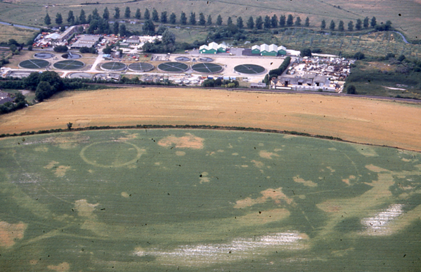
Fig. 2. An aerial view of Mount Pleasant henge from the south. FR 198-30, 5 August 1996 (© Francesca Radcliffe, with permission of Dorset County Museum)

Fig. 3. Mount Pleasant and Conquer Barrow (after Wainwright Reference Wainwright1979, fig. 3 and Barber Reference Barber2014, fig. 6, with permission)
The henge enclosure is defined by a poorly preserved bank represented by a layer of chalk lumps 10 m wide, and corresponding irregular ditch (Wainwright Reference Wainwright1979, 35, 38; pls xixa & b; Linford et al. Reference Linford, Linford and Payne2019). Four entrances were initially identified but a fifth, to the south-west, is now known, the causeway occupied by a series of large irregular pits (Barber Reference Barber2014, 25; Linford et al. Reference Linford, Linford and Payne2019, 11; see Fig. 2). These may represent a blocking or restriction of the entrance, as attested at henges elsewhere (eg, Forteviot Henge 2, Perth & Kinross (Brophy & Noble Reference Brophy, Noble and Gibson2012, 29)). Alternatively, these irregular pits may indicate the presence of an earlier circuit dug prior to the construction of the main henge (Barber Reference Barber2014, 41), an interesting possibility given the recent discovery at Durrington Walls of a circuit of large timber posts pre-dating the henge bank (Parker Pearson et al. Reference Parker Pearson, Chan, Chapman, Gaffney, Garwood, Marshall, Aldrian and Neubauer2017). To the east of Mount Pleasant lies a sunken, straight ‘approach’ feature (Fig. 3) which may form an avenue or roadway leading towards a fording point of the river (Barber Reference Barber2014, 35), again comparable with a similar feature at the east entrance to Durrington Walls that connects it to the River Avon (Parker Pearson et al. Reference Parker Pearson, Pollard, Richards, Thomas, Tilley and Welham2008).
Within the henge enclosure stood a concentric timber and stone monument, Site IV, consisting of five rings of post-holes, a central square setting of stones and posts, and several outlying standing stones (Figs 4 & 5). This structure was surrounded by a circular ditch 43 m in diameter with a single causeway to the north and, from the evidence of chalk rubble filling within the ditch, probably with an external bank (Wainwright Reference Wainwright1979, 10). It has been suggested that this ditch may have been preceded by a series of pits (Barrett Reference Barrett1994, 101; Needham Reference Needham, Needham, Parfitt and Varndell2006, 18).

Fig. 4. Site IV under excavation in 1971 (photo: Peter Sandiford)

Fig. 5. Site IV plan (based on Wainwright Reference Wainwright1979, fig. 6)
Within the Site IV ditch fills at various places around the circuit were many large and fresh flakes of sarsen stone, as well as three hammerstones, associated with Beaker pottery. Radiocarbon dates obtained on charcoal from these upper fills (BM-668, BM-669, and CAR-5) were interpreted as providing an estimate for the construction of the stone settings (Wainwright Reference Wainwright1979, 28) but as Pollard (Reference Pollard1992, 22) has argued, this debris could have easily resulted from the breaking and removal of the stones, rather than their initial erection.
Situated roughly concentrically within the henge enclosure was a timber palisade consisting of an estimated 1600 posts set into a trench 1–2 m wide and 2.5–3 m deep (Wainwright Reference Wainwright1979, 45). In addition, within the north-west quadrant of the enclosure, aerial photographs and geophysical survey show the presence of a partial inner palisade (Barber Reference Barber2014, 29; Linford et al. Reference Linford, Linford and Payne2019, 12). The posts of the main palisade perhaps stood 6 m high, based on an estimate of one-third of the length of each post being below ground level and were likely to have been oak (Wainwright Reference Wainwright1979, 50, 253). Two narrow entrances into this enclosure were discovered on the northern and eastern sides (others may exist); each was flanked by enormous posts 1.8 m in diameter. Some sections of the palisade had been destroyed by fire, in other places the posts decayed in situ, and elsewhere they were deliberately removed (Fig. 6). The palisade was estimated to have been constructed in the early Bronze Age, based on three radiocarbon dates (BM-662, BM-665, and BM-794, see Table 1). This is later than would be expected for a palisaded enclosure (Whittle Reference Whittle1997, 158–60) and seems at odds with the carved chalk objects and Grooved Ware pottery found in the palisade trench (Wainwright Reference Wainwright1979, 79–82, 167). The charcoal sample (BM-665) came from a deposit of burnt material near the top of the palisade ditch and may therefore derive from fuel used to burn the structure, rather than a palisade post.

Fig. 6. Plan of the palisaded enclosure at Mount Pleasant showing patterns of burning, removal, or decay of posts, and the location of samples used for radiocarbon dating (based on Wainwright Reference Wainwright1979, fig. 99)
TABLE 1: MOUNT PLEASANT, DORSET: RADIOCARBON AND STABLE ISOTOPE MEASUREMENTS

Replicate measurements have been tested for statistical consistency and combined by taking a weighted mean before calibration as described by Ward & Wilson (Reference Ward and Wilson1978; T’(5%)=3.8, ν=1; except where stated).
Close to the western entrance of the henge enclosure is a large round mound known as the Conquer Barrow, standing 7 m high and 30 m in diameter. Several investigators noted that the mound appeared to lie on top of the henge bank (Crawford in Piggott & Piggott Reference Piggott and Piggott1939, 158; RCHME 1970, 591; OS card record, Historic England Archive). Wainwright followed this interpretation, recognising the mound as 3–4 m high above a surviving 4 m tall remnant of the henge bank (Wainwright Reference Wainwright1979, 65). The Conquer Barrow today is heavily overgrown and lies partly in private gardens, making further assessment of the earthworks difficult. Excavations have revealed that the mound was once surrounded by a ditch which stopped short of the henge enclosure ditch to the south. On the northern side, the relationship between these two elements was not investigated, nor was the mound itself. An antler pick from the primary chalk rubble of this ditch was radiocarbon dated (BM-795) but the result was rejected as residual, being much earlier than expected given the clear earthwork sequence (Wainwright Reference Wainwright1979, 65). Others have since questioned this, as there is no obvious reason to reject this date (Woodward Reference Woodward1991, 136–40; Sparey-Green Reference Sparey-Green1994; see Barber et al. Reference Barber, Winton, Stoertz, Carpenter, Martin, Leary and Field2010, 157–63). Although Sparey-Green (Reference Sparey-Green1994, 53) has argued that the angular chalk in the segment of the barrow ditch closest to the henge indicates infilling prior to the construction of the henge, this could equally derive from much later levelling of the henge bank and does not provide conclusive evidence. If the Conquer Barrow is of Neolithic date, then it can be placed in the category of late Neolithic round mounds alongside Silbury Hill, Hatfield Barrow at Marden, Great Barrow at Knowlton (Barber et al. Reference Barber, Winton, Stoertz, Carpenter, Martin, Leary and Field2010), and Marlborough Mound (Leary et al. Reference Leary, Canti, Field, Fowler, Marshall and Campbell2013). At present, the interpretation of the earthworks provides the best guide to the sequence, with the henge bank preceding the Conquer Barrow.
AIMS OF THE DATING PROGRAMME
A total of 19 radiocarbon measurements were obtained on material from Mount Pleasant from the British Museum laboratory in 1971–4 (see Table 1) and a single measurement from the University College, Cardiff laboratory in the mid-1970s (Dresser Reference Dresser1985). This was an extensive programme of radiocarbon dating for the time and the results were influential on Wainwright’s interpretation of the sequence. For example, dates obtained from two antler picks excavated from the western entrance ditch (BM-645 and BM-646) were in the region of 200–300 years later than charcoal samples from the northern entrance ditch terminals, leading Wainwright to conclude that the western entrance ditches had been extended after their initial construction (Wainwright Reference Wainwright1979, 44). However, the existing chronology has a number of interpretative issues, either because of the amount of material required for radiocarbon measurement at that time (bulked samples) or the samples selected (unidentified charcoal potentially affected by an ‘old wood’ effect or material obtained from contexts not directly related to archaeological questions of interest).
The aim of this project was therefore to obtain a robust chronology for Mount Pleasant. More specifically, the objectives were to provide precise date estimates for:
The construction of the henge ditch, including whether the western entrance had been extended.
The construction of the palisade enclosure.
The digging of the Site IV ditch.
The sarsen breaking and burning layer in the Site IV ditch.
The infant burials in the upper fills of the henge ditch.
Unfortunately, no suitable material for dating survives from the timber structure of Site IV or the Conquer Barrow ditch. The sampling strategy also aimed to evaluate the existing measurements by submitting new samples from the same contexts where possible.
RADIOCARBON DATING AND CHRONOLOGICAL MODELLING
The new radiocarbon dating programme for Mount Pleasant was conceived within the framework of Bayesian chronological modelling (Buck et al. Reference Buck, Cavanagh and Litton1996). This allows the combination of calibrated radiocarbon dates with archaeological prior information using a formal statistical methodology. At Mount Pleasant a limited number of stratigraphic relationships between structures and between the fills of ditches were available to constrain the radiocarbon dates.
The Mount Pleasant archive is held at Dorset County Museum in Dorchester. Unfortunately, the animal bone, at some point during or after its analysis for publication, has been re-organised into species type and broad time period, so that it is now impossible to assign the bones to their original contexts. The remainder of the material from the site is in good condition and, except for an infant burial from the northern entrance of the henge ditch (Cutting XXVIII) which had been treated with preservative, was suitable for radiocarbon dating.
Results and Bayesian chronological modelling
A total of 59 radiocarbon measurements are now available from Mount Pleasant (Table 1; Appx S2). All are conventional radiocarbon ages (Stuiver & Polach Reference Stuiver and Polach1977). The chronological modelling described in this section has been undertaken using OxCal 4.3 (Bronk Ramsey Reference Bronk Ramsey1995; Reference Bronk Ramsey2009; Reference Bronk Ramsey2017) and the internationally agreed calibration curve for the northern hemisphere (IntCal13; Reimer et al. Reference Reimer, Bard, Bayliss, Beck, Blackwell, Bronk Ramsey, Buck, Cheng, Edwards, Friedrich, Grootes, Guilderson, Haflidason, Hajdas, Hatté, Heaton, Hoffmann, Hogg, Hughen, Kaiser, Kromer, Manning, Niu, Reimer, Richards, Scott, Southon, Staff, Turney and van der Plicht2013). The model is defined by the OxCal CQL2 keywords and by the brackets on the left-hand side of Figures 7–10. In the diagrams, calibrated radiocarbon dates are shown in outline and the posterior density estimates produced by the chronological modelling are shown in solid black. The Highest Posterior Density intervals which describe the posterior distributions are given in italics.

Fig. 7. Overall structure of the chronological model for activity at Mount Pleasant. The component sections of this model are shown in detail in Figs 7–9. The large square brackets down the left-hand side of the diagram, along with the OxCal keywords, define the overall model exactly (http://c14.arch.ox.ac.uk/)

Fig. 8. Probability distributions of dates from the henge. Each distribution represents the relative probability that an event occurs at a particular time. For each of the dates two distributions have been plotted: one in outline, which is the result of simple radiocarbon calibration, and a solid one, based on the chronological model used. Measurements followed by a question mark have been excluded from the model for the reasons explained in the text and are simple calibrated dates (Stuiver & Reimer Reference Stuiver and Reimer1993). The large square brackets down the left-hand side of Figs 6–9 along with the OxCal keywords define the overall model exactly


The models
The chronological model for Mount Pleasant is defined in Figures 7–10, and the Highest Posterior Density intervals for key parameters are given in Table 2. This is based on the stratigraphic sequence revealed through excavation. The relationships that are included in the model are summarised in Appendix S2, Figs S2.a–c. This model has good overall agreement (Amodel: 98; Figs 7–10).
TABLE 2: HIGHEST POSTERIOR DENSITY INTERVALS FOR THE DATES OF KEY CONSTRUCTIONAL; EVENTS AT MOUNT PLEASANT, DERIVED FROM THE MODELS SHOWN IN FIGS 6–10

The henge: Four samples, three single fragments of charcoal from short-lived tree taxa and a bulk sample of Quercus sp.Footnote 2 have been dated from the buried soil preserved beneath the bank of the henge enclosure. Fifteen samples have been dated from the henge ditch, six from the western and nine from the northern entrance. From the western entrance measurements are available on five antler picks from the bottom of the ditch or its very earliest silting; of these, the two British Museum measurements (BM-645–6) are considerably younger, >300 BP, than the three more recently AMS dated samples (which are statistically consistent (T’=2.3; T’(5%)=6.0, ν=2; Ward & Wilson Reference Ward and Wilson1978; Table 1). The British Museum dates therefore appear to be inaccurate and have been excluded from the model. The British Museum measurements were made prior to the widespread introduction of formal approaches to quality assurance, through a series of ongoing international laboratory inter-comparison exercises with published results (Otlet et al. Reference Otlet, Walker, Hewson and Burleigh1980; Rozanski et al. Reference Rozanski, Stichler, Gonfiantini, Scott, Beukens, Kromer and van der Plicht1992; Scott et al. Reference Scott, Aitchison, Harkness, Cook and Baxter1990; Reference Scott, Cook and Naysmith2010; Scott Reference Scott2003). There have also been significant improvements in the pre-treatment methods used for bone samples since the early 1970s (Longin Reference Longin1971; Brown et al. Reference Brown, Nelson, Vogel and Southon1988; Law & Hedges Reference Law and Hedges1989).
A sample of bulk charcoal (BM-664) from the aeolian derived upper fill (Layer 3) of the north terminal of the western entrance of the henge ditch could have an unknown-age-at-death offset (Bowman Reference Bowman1990). It has therefore been incorporated as a terminus post quem (TPQ) in the model.
A series of nine samples form a stratigraphic sequence through the fills of the eastern terminal of the north entrance of the henge. The results from six samples of bulked Quercus sp. charcoal from Layers 6–8 and 10–12, have been incorporated as termini post quos (TPQ) in the model given the potential for them to have a significant age at death offset. Two antlers (SUERC-72738 and Cutting XXIX: Layer 11) from the primary silting of the ditch are statistically consistent (T’=0.8; T’(5%)=3.8, ν=1). An infant burial (OxA-35740) cut from the base of Layer 8 into Layer 9 in the east terminal is Iron Age in date, surprisingly late given that Layer 9 represents a relatively low filling of the ditch. This is perhaps because the burial was near the centre of the more than 10 m wide ditch which would have eroded and infilled initially from the sides. It is likely that a second, undated, child burial cut from the same level in this part of the ditch also dates to the Iron Age. The measurement has been excluded from the model because the inhumation does not contribute to understanding the late Neolithic chronology of the henge.
The Conquer Barrow: A single antler pick (BM-795) from the primary chalk rubble of the Conquer Barrow’s ditch is interpreted as deriving from its digging and therefore in the absence of any further available samples provides a credible date for its construction, assuming that material from this ditch was used to build the mound. Given the sequence indicated by several observations of the earthworks (see above), it is accepted here that the construction of the barrow took place after the construction of the henge enclosure bank. Alternative readings of the relationship between the earthworks of the henge enclosure and the Conquer Barrow are presented in Appendix S3, with discussion of the chronological implications for the Mount Pleasant sequence.
Site IV ditch: A minimum number of 11 antler picks, all with worn tines and occasional signs of battering behind the burr, were recovered from the Site IV ditch. A British Museum measurement (BM-666) on antler from Segment VII Layer 10 is statistically consistent with AMS measurements (UBA-34290 and SUERC-72731) on a further two antlers from this layer (T’=4.5; T’(5%)=6.0, ν=2). These results imply that the inaccurate measurements identified on antlers from the henge ditch (BM-645–46) and palisade (BM-662) might not be the result of a systematic British Museum laboratory problem such as that identified in 1980–1984 (Bowman et al. Reference Bowman, Ambers and Leese1990). Although two further British Museum measurements on samples of Quercus sp. (BM-663) and Bos primigenius (BM-667) from Segment VII Layer 10 are statistically consistent with the three determinations on antler from this layer (T’=5.7; T’(5%)=9.5, ν=4) they have been included as TPQ in the model given the uncertainty over the taphonomy of the aurochs bone, and the possibility of age-at-death offset in the charcoal.
Six measurements on charcoal, one unidentified (CAR-5), two comprising bulked Quercus sp. (BM-668–9), and three short-lived single entity samples (ETH-92535–7) are from deposits relating to the secondary silting of the ditch. Given the potential for an old wood effect CAR-5 and BM-668–9 only provide TPQ for their contexts. The three determinations from Segment XIII, Layer 5 (ETH-92535–7) are statistically consistent (T’=0.6; T’(5%)=6.0, ν=2) and provide an estimate for the deposition of Layer 5 with its burnt deposit containing quantities of sarsen stone.
In our preferred model the dated antler from Segment VII Layer 8 (Table 1; Segment VII: Layer 8) has been interpreted as deriving from a recut of the ditch in this part of the circuit (Wainwright Reference Wainwright1979, fig. 10), where the south side of the ditch is angular and irregular with deposits below Layer 8 filling two of the irregularities.Footnote 3 Adding further weight to the existence of a recut is the fact that frequencies of chalk rubble in the pit and below Layer 8 are comparable with those in the basal fills of adjoining Segments VI and VIII (Wainwright Reference Wainwright1979, figs 9–11) while in Layer 8 there is clearly much less chalk rubble. In this reading of the stratigraphy the ‘pit’ (Wainwright Reference Wainwright1979, fig. 10) is interpreted as the remnant of an original ditch, not a pit surviving beneath the ditch cut-line, that along with other possible examples might indicate an original circuit of pits or shafts (Needham Reference Needham, Needham, Parfitt and Varndell2006, 18).
Palisaded enclosure: From the palisaded enclosure a total of 15 samples have been dated. Seven measurements are available on single fragments of Quercus sp. charcoal sapwood from three post-pipes. In prehistoric English oaks the amount of sapwood varies between 10 and 55 years (Hillam et al. Reference Hillam, Morgan, Tyers and Ward1987) and thus the best estimate is provided by the latest dated sapwood for each post (post_2, post_3, and south_pipe_11; Fig. 10).
Thirty-eight antler picks were recovered from the chalk rubble packing material which had been placed around the timber uprights. The majority of these were from near the base of the ditch and showed extensive signs of wear consistent with them having been used to excavate the ditch containing the palisade. Of the six antlers that have been dated, the British Museum determination (BM-662) is again significantly younger than the more recently dated AMS samples (all five measurements are statistically consistent (T’=8.9; T’(5%)=9.5, ν=4). As the British Museum result appears to be anomalous it has been excluded from the model.
A sample of Quercus sp. charcoal from Layer 3 (Cutting III), a deposit of carbonised material sealing the top of the palisade trench and stratigraphically above the packing material (Layer 5), could have an unknown age-at-death offset and therefore has been included in the model as providing a TPQ. The taphonomy of BM-794, derived from a selection of animal bone (unknown species) from the upper deposits (Layers 3–6) of the palisade trench in Cutting XVIII, is unknown but the sample probably represents material used to backfill this section of the palisade following removal of the posts (Wainwright Reference Wainwright1979, 61). Given that the dated sample comprised bulked material that could be of different ages it has also been included as a TPQ in the model.
The two independent estimates for the completion of the palisade enclosure (end_palisade_posts & end_palisade_antler; Fig. 10) have combined (Fig. 11), based on the interpretation that they represent a single planned construction, to provide an estimate for its building.

Fig. 11. Combined probability distribution estimating the construction date of the palisade enclosure, if it is interpreted as representing a single planned construction
A STRUCTURAL NARRATIVE
Although two of the four dated samples from the old land surface beneath the henge bank were associated with a substantial assemblage of early Neolithic Plain Bowl pottery, the date estimates clearly relate to carbonised material deriving from later activity. This activity is represented by Peterborough Ware scattered in the north-eastern part of the palisade trench, and by two transverse arrowheads and two sherds of Grooved Ware pottery found under the henge bank (Wainwright Reference Wainwright1979, 77, 141). These indicate some activity prior to the construction of the earthwork enclosure, although, as yet, the late Neolithic evidence does not appear to be on the scale of comparable enclosures such as Durrington Walls.
The model shown in Figures 7–10 and summarised in Figure 12 and Table 2 provide an estimate for the digging of the henge ditch of 2610–2495 cal bc (95% probability; build_henge; Fig. 12), probably 2580–2530 cal bc (68% probability), assuming a unitary construction for the henge ditch. The number of dated antler picks available from the enclosure ditch is insufficient to identify any difference in date between the two entrances. Following our preferred interpretation that the Conquer Barrow was built on top of the henge bank, the single dated antler from its ditch, BM-795 provides an estimate for its building of 2580–2460 cal bc (95% probability; BM-795; Fig. 12), probably 2525–2475 cal bc (68% probability).

Fig. 12. Probability distributions of dates of major constructional events (note some of the tails of these distributions have been truncated to enable detailed examination of the highest area of probability)
The ditch surrounding Site IV is estimated to have been completed in 2555–2400 cal bc (95% probability; dig_site_IV_ditch; Fig. 12), probably 2515–2440 cal bc (68% probability) in our preferred model. Alternative estimates resulting from different readings of the stratigraphy, following Wainwright (Reference Wainwright1979; Appx S3, Figs S3, k–n) and Needham Reference Needham, Needham, Parfitt and Varndell2006 (Appx S3, Figs S3.o–r) suggesting that the ditch was dug in 2465–2345 cal bc (95% probability; dig_site_IV_ditch; Appx S3, Fig. S3.m) probably 2450–2390 cal bc (68% probability) or 2465–2360 cal bc (95% probability; dig_site_IV_ditch; Appx S3, Fig. S3.q), probably 2455–2405 cal bc (68% probability).The lack of any suitable dating material directly relating to the construction of Site IV timber structure means that this remains undated.
The palisade is estimated to have been built in 2560–2440 cal bc (95% probability; build_palisade; Fig. 12), probably 2530–2465 cal bc (68% probability), again assuming a unitary construction.
It is possible to determine the relative order in which the various parts of Mount Pleasant were built (Appx S2, Table S2.A). For example, based on the available dating, it is 80% probable that the henge enclosure ditch and bank were the first elements of the Mount Pleasant complex to be constructed. It is also possible to estimate the length of time between the constructions of the various constituent parts of Mount Pleasant (Appx S2, Fig. S2.d, Table S2.B). For example, the length of time between the construction of the henge enclosure and Site IV ditch, which encompasses the duration of major construction activity on the site is estimated to be −15–170 years (95% probability; Appx S2, Fig. S2.d), probably 35–125 years (68% probability).
It is important to note that the dating evidence only allows us to estimate when the different parts of Mount Pleasant were constructed, not the duration over which they remained in use or the date at which they were abandoned. However, the ditches of the henge have no evidence for recutting, nor does the palisade show signs of repair or rebuild. It is possible to estimate the minimum length of the time over which the henge enclosure ditch silted up in the area of the northern entrance to the level of Layer 6, which took place over 565–880 years (95% probability, Appx S2, Fig. S2.e), probably 645–805 years (68% probability). The infant burial, cut into Layer 9 and dating to the middle Iron Age, shows that the ditches remained open for a long period (also attested at the western entrance by the bronze axe on the surface of Layer 10). A date obtained from charcoal from Layer 3 within the pit at the northern ditch terminal of the western entrance makes it possible to estimate a duration of 445–1090 years (95% probability; Appx S2, Fig. S2.e), probably 635–940 years (68% probability) for the infilling of the ditch in this location.
Based on calculations that oak rots at a rate of 15 years for every 5 cm of post diameter (Wainwright Reference Wainwright1989, 155) those palisade posts (30–50 cm in diameter; Wainwright Reference Wainwright1979, 50) that were not burnt or removed could have stood for 90–150 years. The enormous 1.8 m diameter posts at the eastern entrance could potentially have stood for centuries. Where identified in the post-holes of Ring A, the posts of Site IV were smaller, at 28 cm diameter (Wainwright Reference Wainwright1979, 23); these would therefore have remained standing for about 80 years, if left.
The length of time that elapsed between the digging of the Site IV ditch and Layer 5, the burning associated within sarsen fragments in the ditch, is estimated to be 80–310 years (95% probability; Appx S2, Fig. S2.f), probably 135–255 years (68% probability). Presuming that the Site IV ditch was contemporary or later than the settings within it, this suggests that the sarsen settings stood for a period of about a century and a half (median DifferenceFootnote 4 dig_site_IV_ditch/Layer 5 is 190 years) before being broken up.
DISCUSSION
The development of Mount Pleasant
The previous chronological sequence at Mount Pleasant gave the impression of activity taking place over an extended period of the late Neolithic and early Bronze Age. This longevity led Thomas to suggest that the monument had “a significant role in the reformulation of social order” in the local area (Thomas Reference Thomas1996, 184). The chronology presented here vastly reduces the length of time over which the various components of the site were constructed, requiring a radical reconfiguration of the monument’s significance in late Neolithic society. The major construction activity took place in the late Neolithic over a timespan of probably 35–125 years (68% probability; Appx S2, Fig. S2.d). This period is the duration of perhaps 2–5 successive generations (estimated at 25 years), perhaps even with a period of living memory (Fig. 12). The grandchildren of those who helped to excavate the enormous ditches of the henge could have cut down the trees and erected the posts of the palisaded enclosure. Similarly, it may have been their children who decided to dig the ditch around Site IV.
The earliest major construction activity was the digging of the enormous henge ditch and the creation of its associated bank. The enclosure was built to separate the highest and most westerly end of the Alington ridge, overlooking a fording point of the River Frome (Fig. 1). The construction of the earthwork enclosure was a colossal undertaking which, contrary to Wainwright’s initial interpretation, now appears to have been created in one relatively short episode (although the bank on the southern side may have been heightened later; Barber Reference Barber2014, 27). Such a construction project would have required significant labour input and logistical support from many, suggesting perhaps that people may have been drawn from a wider area than the immediate Dorchester region.
The palisaded enclosure has now been relocated to a period of intense late Neolithic activity at Mount Pleasant, rather than in the developed early Bronze Age. The wide causeway through the henge ditch to the north has a corresponding narrow entrance (less than 1 m wide) in the circuit of the palisaded enclosure, flanked by enormous timber posts. The henge entrance to the east is also aligned with a narrow entrance in the palisade. However, the south-west and south-east henge entrances do not appear to have corresponding gaps in the palisade, and the line of the palisade adjacent to the fifth, southern, entrance (Barber Reference Barber2014, 25) has not been excavated. Therefore at least two of the original henge entrances were blocked by the position of the inner palisade, a relatively short time after the henge was constructed (15–100 years (68% probability)). Once the palisade had been built, those entering the henge using these entrances would have had to circumnavigate the palisade to the north-east or north-west in order to access the interior of the henge. The close-set nature of the posts (Wainwright Reference Wainwright1979, fig. 33) suggests that physical and visual access was prevented and closely controlled. The henge entrances left open were those that led north and east towards the river, emphasising the importance of arrival or departure by the river or across the ford, or the role of the river as part of rituals or ceremonies.
The remarkable oak posts flanking the eastern entrance were 1.8 m in diameter, set 2 m deep in the ground (Wainwright Reference Wainwright1979, 63); each is estimated to have weighed a staggering 17 tonnes (Gibson Reference Gibson, Gibson and Simpson1998, 75). Many hundreds of other posts, from substantial felled trees, would have been needed for the construction of the rest of the circuit. Where were the trees for this structure, and for Site IV, brought from? Snails from the ditches of Alington Avenue long barrow, Flagstones, and Mount Pleasant indicate an open environment with intensive grazing and some cultivation from the middle–late Neolithic (Woodward Reference Woodward1991, 129; Healy Reference Healy1997, 184; Wainwright Reference Wainwright1979, 7, respectively). Although there was more open scrubby woodland in the vicinity of the Greyhound Yard (Davies et al. Reference Davies, Bellamy, Heaton and Woodward2002, 192), the evidence suggests that established woodland with trees of the type needed was likely to have been located at some distance from the site. The charcoal evidence from Mount Pleasant shows the probable deliberate selection of oak trees, the most common choice of timber for late Neolithic palisaded enclosures and timber circles across Britain and Ireland (Millican Reference Millican2016, 72; Noble Reference Noble2017, 145). Oak may have been selected due to its size, longevity, or durability, but the tree may also have had an important place within perceptions and beliefs relating to woodland and the landscape. Suitable tall and straight tree trunks may have been transported across relatively long distances over land or floated along waterways. The sheer numbers of oak trees felled for the palisaded enclosure and concentric circles at Mount Pleasant would have had a noticeable impact on the landscape, whether this was concentrated in the local area or spread over a much wider region. Although calculations can be made of the amount of mature woodland needed to procure the number of suitable oak trees (Whittle Reference Whittle1997, 154), in this case over 10 ha, it is not known how far the trees were transported. The felling of these trees may have been entangled with the clearance and management of woodland for other purposes (Brophy & Millican Reference Brophy and Millican2015, 319). Alternatively, it has been suggested that sacred trees were incorporated into these enclosures and monuments (Noble & Brophy Reference Noble and Brophy2011, 81); perhaps individual communities brought their own trees to contribute to the building project, an explanation suggested for stone circles with varied lithologies such as the Ring of Brodgar (Downes et al. Reference Downes, Richards, Brown, Cresswell, Ellen, Davies, Hall, McCulloch, Sanderson, Simpson and Richards2013, 106).
In the decades around 2500 cal bc, at a similar time to when the palisaded enclosure was being constructed, the Conquer Barrow was built on top of the henge bank. Originally standing at least 7 m high, it would have provided a distinct vantage point from which it would have been possible to view activities taking place inside the henge, as has been argued for Droughduil mound, overlooking the Dunragit palisaded enclosures (Thomas Reference Thomas2015, 173). It is tempting to link the construction of the mound to the palisade, with the more restricted entrances and convoluted routes towards the centre perhaps requiring the construction of a viewing platform. This may also be the date that the henge bank along the south was heightened (Barber Reference Barber2014, 27), again providing a possible vantage point over activities in the interior.
The sense that each post, or section of the palisaded enclosure, may have had an identity is further supported by subsequent differential treatment of the standing posts (Fig. 6). Individual posts or sectors may have retained meaning as constituent parts of this larger monument, perhaps being associated with the geographic locations where they grew, or with individual people or groups. Posts may have been carved, painted, or decorated. As a substance, wood changes – it weathers, rots, crumbles, and decays, mapping the passing of time (Fowler Reference Fowler and Williams2003; Thomas Reference Thomas, Cummings and Fowler2004, 183), a process that might be delayed or prolonged through charring (see below). Animals, birds, and insects will inhabit rotten wood, gnaw at the bark, or dig at the base of posts. Mosses, lichens, and fungi grow. Vertical timbers, if left, will eventually rot through at ground level and collapse quite dramatically, possibly setting off a domino effect with several posts falling at once. Among Ponca and Omaha Native American communities, timber poles could be revered as sacred mysteries, embodied ancestors and living beings. As they decay, the posts lean and therefore point; they receive offerings, are routinely attended to and are provided with their own sacred bundles (Pauketat Reference Pauketat2012, 83). It is possible that these dramatic changes to a site were carefully interpreted by later visitors to the monument and were perhaps related back to the histories of individual posts. The falling of a post might reveal something about the past or even predict the future. An episodically decaying monument would have been an active and dynamic place, ripe for interpretation and potentially influencing human actions. Clearly those palisade posts left to rot would have served as visible and powerful reminders of the monument and the activities that took place there for several generations (Millican Reference Millican2016, 74).
Like some other palisaded enclosures in southern Britain and Ireland, a substantial portion of the palisaded enclosure at Mount Pleasant was burnt, particularly its southern side, with the post-holes containing large quantities of charred oak (Fig. 6). If this burning took place in one episode, it would have been a memorable event for those who witnessed it, a communal ‘flashbulb memory’ (Noble Reference Noble2006, 58; Brophy et al. Reference Brophy, Goecheritz and Macgregor2017, 5). Perhaps this dramatic event was prescribed from the outset, marking the end of a ritual cycle (Whittle Reference Whittle1997, 158) or it could represent some form of slighting or attack on the enclosure. Certainly, the destruction and removal of posts, whether by natural processes or human action, was as much a part of the dynamism of timber monuments as their initial construction (Thomas Reference Thomas, Cummings and Fowler2004; Millican Reference Millican2016)
The post-holes of the Mount Pleasant palisade sometimes contained burnt posts as charcoal lumps and, occasionally, this charcoal extended to the base of the original posts (Wainwright Reference Wainwright1979, 54). In two instances (in Cuttings XII and XVI) burnt chalk was recorded, suggesting that these posts burnt in situ at high temperatures (Wainwright Reference Wainwright1979, 59, 60). However, it cannot be assumed that burning only occurred at a time of destruction (Brophy & Millican Reference Brophy and Millican2015, 311). Although there is some doubt as to its effectiveness, post-base charring may have been undertaken to prolong the life of standing timbers, as suggested for the Hindwell II enclosure (Gibson Reference Gibson, Gibson and Simpson1998, 69). The charring would have to extend to the ground surface where posts will rot first (Speak & Burgess Reference Speak and Burgess1999, 19). An alternative explanation is that the entire lengths of some posts were deliberately charred before being erected as part of the enclosure. The appearance of charred black posts standing against the white chalk of the palisade trench upcast and still largely open henge ditches would have been particularly striking (Fig. 13).

Fig. 13. King and Queen 1991. David Nash. Sculpture, charred oak, 3.55 m tall. Black charred posts against the white slumped chalk of the henge ditches would have formed a dramatic visual impression (© David Nash, with permission)
The last dated major construction activity at Mount Pleasant was the digging of the ditch surrounding the concentric timber and stone monument at Site IV (50.4% probable; Appx S2, Table S2.A). It must be remembered that the concentric monument itself has not been dated and may pre-date the enclosing ditch. As Gibson (Reference Gibson, Gibson and Simpson1998, 36) has noted, where timber circles and henges are found together, the timber structure was usually constructed before the enclosing bank and ditch. We suggest that the timber elements of Site IV were erected at a similar time to the palisaded enclosure, with the surrounding ditch dug later. This ‘henging’ (Warner Reference Warner2000) or ‘wrapping’ (Richards Reference Richards and Richards2013) of the site may derive from a strategy of containment for the timber structure, the deposits made within or the activities that took place there.
Site IV was constructed on the highest point of the ridge (Fig. 2), probably deliberately sited to provide the most impressive view to those approaching from lower ground. The timber structure has four ‘avenues’ or pathways which lead towards the centre of the site, a pattern also seen at the Sanctuary, Wiltshire (Pollard Reference Pollard1992) and within the largest circle at Stanton Drew (Linford et al. Reference Linford, Linford, Payne and Greaney2017, 4). Although these four approaches may indicate the way that individuals moved into the centre of the circles, this is not borne out by analysis of patterns of deposition of Grooved Ware and other objects at the site. Instead, these indicate circular movements, with people moving between the rings of posts and depositing objects in appropriate arcs (Thomas Reference Thomas1996, 198–202). However, detailed analysis of the deposition of material culture within Site IV is not possible as the post-holes were severely truncated. Thomas (Reference Thomas1996, 202) has drawn attention to the fact that the Grooved Ware deposited in the Site IV ditch had a different character to that deposited within the henge ditch, where significant concentrations were placed in the northern entrance terminals. Whereas the Grooved Ware pottery from the primary layers of the henge ditch was dominated by pots with applied cordons, the assemblage from Site IV displays incised diagonals and herringbone motifs, or complex panels of decoration. This difference was interpreted by Thomas as alternate types of pots being appropriate for use and deposition in parts of the site. However, it can now be seen that these two components of the site are probably 35–125 years apart (68% probability; Appx S2, Table S2.B); the change in decoration may, at least partly, reflect the development of this pottery style over time.
It has been argued that the addition of standing sarsens at the perimeter and centre of Site IV helped to clarify patterns of movement, by blocking access to the entrance of each pathway (Thomas Reference Thomas1996, 198). However, there is no clear indication of a stratigraphic sequence between the timber and stone elements, and it is quite possible that the two material types stood together concurrently, or that the succession from stone to timber occurred in a short time-frame. This is supported by four pits at the centre of the site, linked by stone-holes to form a square (Wainwright Reference Wainwright1979, 28). These shallow pits may have held upright posts or stones and would therefore bring Site IV into line with other ‘square-in-circle’ monuments in Britain and Ireland. Rather than being necessarily late in the sequence, this square arrangement at the centre may instead have been integral to the concentric structure.
Only two post-pipes were found within the post-holes of Site IV during excavation (Wainwright Reference Wainwright1979, 26) although, as the features of this structure were severely truncated, it is not possible to tell if the posts were removed or rotted in situ. Around one or two centuries after the ditch around Site IV had been dug (Fig. 9), it had silted up considerably and, within it, a layer of sarsen chips and burning with Beaker pottery was deposited. This is most likely related to sarsen stone breaking and destruction than to their initial erection, particularly as several sarsen mauls were found at this level and above (Wainwright Reference Wainwright1979, 163). By this stage the timbers of Site IV are likely to have also been removed or to have rotted in situ. Note that this sarsen breaking is unlikely to have occurred at the same time as the destruction of the timber palisade, as the date estimate for the layer in the Site IV ditch does not overlap with the single radiocarbon date (BM-665) which provides a TPQ for the burning of the palisade.
Continued activity at Mount Pleasant in the Chalcolithic is attested by the continued deposition of varied styles of Beaker pottery in the top of the palisade trench, in the Site IV ditch and in the henge ditch, while sherds of Collared Urn, Bucket Urn, and Food Vessels dominate above Layer 8 of the henge ditch fill (Thomas Reference Thomas1996, 218). An early Bronze Age decorated bronze flat axe was placed in the northern terminal of the henge ditch at the western entrance (Wainwright Reference Wainwright1979, 40). At this date, it is possible that some of the posts of the palisaded enclosure were still standing. The wide henge ditches remained as distinct earthworks, up to 2 m deep into the Iron Age, when at least one and probably more children were buried in the ditch. This may be associated with contemporary activity represented by stake-holes within the ditch and an Iron Age round-house with associated pits and gullies built on the location of Site IV (Wainwright Reference Wainwright1979, 31–4).
Henge enclosures
There are long-recognised parallels between the size, layout, and form of Mount Pleasant henge and other large henge enclosures in southern England, particularly those of Avebury, Marden, Durrington Walls, and the southern henge at Knowlton (Wainwright Reference Wainwright1989). However, the elevated ridge-top position of Mount Pleasant is different to these other examples, which enclose dry valleys or are located on lower lying ground. In fact, the position of Greyhound Yard to the west is more closely comparable to these other henge enclosures, particularly with Durrington Walls. Recent excavations and scientific analyses have underlined the parallels between henge enclosures in southern England. There is evidence for large-scale feasting on meat from animals raised on a variety of geologies at Marden, Durrington Walls and Mount Pleasant, suggesting movement over distances of at least 50 km in the latter, and considerably more at the other sites (Madgwick et al. Reference Madgwick, Lamb, Sloane, Nederbragt, Albarella, Parker Pearson and Evans2019). Comparable chalk and stake-built buildings have been found at Marden and Durrington Walls (Leary & Field Reference Leary, Field and In2012; Parker Pearson Reference Parker Pearson2012). The henge bank at Durrington Walls is estimated to have been constructed in early 25th century cal bc (Parker Pearson et al. Reference Parker Pearson, Marshall, Pollard, Richards, Thomas, Welham, Fokkens and Harding2013, 171). A single date exists on unknown material from the enclosure at Knowlton (2570–2190 cal bc 2σ; Beta-141096, 3890 ± 60 bp; Gale Reference Gale2017, 106) and the henge enclosure at Marden also dates to the mid-3rd millennium cal bc (Worley Reference Worleyforthcoming). Although a chronological model of scientific dates has been published for Avebury (Healy Reference Healy2016), the samples were obtained in a piecemeal fashion over several years. This provides a provisional estimate of the construction of the henge earthwork in 2580–2470 cal bc (95% probability; Healy Reference Healy2016, fig. 9: dig_Avebury_ditch), probably 2530–2485 cal bc (68% probability). The archive from Avebury contains potential samples that could be used in a programme of dating to refine this chronology. Mount Pleasant therefore fits into an emerging picture that these large henge enclosures in southern England date from the centuries around 2500 cal bc.
Palisaded enclosures
The estimate for the construction of the Mount Pleasant palisaded enclosure, 2530–2465 cal bc (68% probability, see above) places it firmly within the currency of large timber palisades constructed across Britain and Ireland in the late Neolithic, for which radiocarbon dates are available from 12 sites (Figs 14 & 15; Appx S4). The form, nature, and type of cultural deposition (carved chalk, animal bones, Grooved Ware pottery) at the site and the varied treatment of the posts by burning, removal, or decay, all find ready parallels within this late Neolithic group (Gibson 1998; Reference Gibson and Gibson2002; Noble & Brophy Reference Noble and Brophy2011). Those palisaded enclosures that are well-dated (Mount Pleasant, Hindwell, Greyhound Yard, and Forteviot) now tightly cluster in the centuries around 2500 cal bc.Footnote 5 These date estimates do not support previous suggestions that enclosures with continuous ditches developed out of earlier enclosures with well-spaced individual posts (Whittle Reference Whittle1997, 161; Gibson Reference Gibson, Gibson and Simpson1998, 71). The double palisaded enclosure at Marne Barracks, Catterick, does however appear to be an outlier, suggested by its slightly later date, its unusual layout (wide entrances and radially aligned posts), and geographic isolation (Hale et al. Reference Hale, Platell and Millard2009; Fig. 15). The estimated date for the palisaded enclosures at West Kennet currently falls in the middle Neolithic (Bayliss et al. Reference Bayliss, Cartwright, Cook, Griffiths, Madgwick, Marshall, Reimer, Bickle, Cummings, Hofmann and Pollard2017); discrepancies in the dating of this site will hopefully be resolved through new analysis of material from recent excavations.


Fig. 15. Map of the British Isles showing the location of henge enclosures, palisaded enclosures, and late Neolithic round mounds. Open symbols denote probable sites
The form of the Mount Pleasant palisade, with close-set posts set in a continuous ditch, is unusual in this wider group, but paralleled most closely at West Kennet. Most other examples of timber enclosures with uprights set in continuous bedding trenches date to the early Neolithic. These are more appropriately termed ‘fenced sites’; smaller in size and with smaller posts (Gibson Reference Gibson, Gibson and Simpson1998, 73). Those at Orsett, Essex, Haddenham, Cambridgeshire, and Donegore, Co. Antrim are associated with ditched causewayed enclosures (Oswald et al. Reference Oswald, Dyer and Barber2001, 52; Mallory et al. Reference Mallory, Nelis and Hartwell2011) whereas examples at Knowth, Co. Meath, Lyles Hill, Co. Antrim, Thornhill, Co. Derry, and Tullahedy, Co. Tipperary enclose or are associated with settlements (Eogan & Roche Reference Eogan and Roche1997, 44–8; Sheridan Reference Sheridan, Darvill and Thomas2001, 178; Logue Reference Logue, Armit, Murphy, Nelis and Simpson2003; Cleary & Kelleher Reference Cleary and Kelleher2011).
The relationship between the pair of palisaded enclosures at Mount Pleasant and Greyhound Yard positioned along the same river, is paralleled by the enclosures of Forteviot and Leadketty located only 4 km apart on the River Earn (Brophy & Noble Reference Brophy, Noble and Gibson2012; Brophy & Noble Reference Brophy and Nobleforthcoming). Each of these pairs has contrasting patterns of deposition and different styles of timber construction. Clusters of palisaded enclosures are also known; four enclosures were built in close proximity in the Walton Basin (including the Hindwell double palisaded enclosure, Jones & Gibson Reference Jones and Gibson2017) and two at West Kennet (Whittle Reference Whittle1997). The number of circuits ranges from one to a maximum of three (in the case of Dunragit), and the patterning of posts varies, Leadketty had small and large alternate posts (Noble & Brophy Reference Noble, Brophy, Furholt, Hinz, Mischka, Noble and Olausson2014, 70), Meldon Bridge had pairs of smaller posts separated by single larger posts (Speak & Burgess Reference Speak and Burgess1999, 15) and the enclosures at Marne Barracks had paired posts set in radially aligned slots (Hale et al. Reference Hale, Platell and Millard2009, 268). At Blackshouse Burn a low stony bank was constructed between the two circuits of posts (Lelong & Pollard Reference Lelong and Pollard1998, 43). Other possible examples, as yet unexcavated, include a curving alignment of pits at Kinloch in Fife (Noble & Brophy Reference Noble and Brophy2011, 64) and an extraordinary triple palisaded enclosure around Newgrange in Co. Meath (Condit & Keegan Reference Condit and Keegan2018).
Gibson’s typology, dividing palisaded enclosures into four types based on the spacing of the posts (Gibson Reference Gibson and Gibson2002; Jones & Gibson Reference Jones and Gibson2017), seems overly complex for such a small number of monuments and ignores other key characteristics of these sites, such as their topographic position or the types of activity that they enclose. The recent discovery of a palisaded enclosure beneath the henge bank at Durrington Walls (Parker Pearson et al. Reference Parker Pearson, Chan, Chapman, Gaffney, Garwood, Marshall, Aldrian and Neubauer2017) raises the possibility that several earthwork ‘henge enclosures’ in southern Britain may have had earlier timber iterations, showing that some earthen enclosures had similar biographies and patterns of use to timber enclosures. This was not a chronological relationship; although the timber enclosure at Durrington Walls was replaced by an earthwork henge, the opposite sequence is evident at Mount Pleasant, with the palisaded enclosure built after the henge enclosure (92.4% probable; Appx S2, Table S2.A). Alternatively, the presence of large pits within the southern entrance causeway of the henge may indicate that another palisade stood on the site prior to the earthen henge (Barber Reference Barber2014, 25–6), thereby implying a rebuilding or repositioning of the timber enclosure during the history of the site. Further dating programmes on samples which relate directly to the construction of other palisaded enclosures will provide more precise estimates for their currency and may elucidate any regional trends in the development and spread of this monument type.
Round mounds
Although no further samples relating to the Conquer Barrow were available for dating, it is possible to reassess the available estimate (BM-795) considering other recent work on late Neolithic round mounds. On the basis of the available evidence, the construction of the Conquer Barrow and the palisaded enclosure are broadly contemporary (Appx S2, Table S2.A), although it should be remembered that there are 16 likelihoods from the palisaded enclosure, and only one from the Conquer Barrow ditch. Comparison shows that the Conquer Barrow may be one of the earliest large round mounds in southern England, being perhaps contemporary with the Marlborough Mound and earlier than both the Hatfield Barrow and Silbury Hill (Fig. 16). There is a clear association between these well-dated round mounds and nearby large timber or earth enclosures (Fig. 15), with the exception of Marlborough Mound; perhaps a palisaded enclosure or henge enclosure lies underneath the nearby town (Leary et al. Reference Leary, Canti, Field, Fowler, Marshall and Campbell2013, 58). A complementary role for enclosures and large mounds has been suggested by Thomas in his discussion of the palisaded enclosure at Dunragit, where the avenue-like entrance aligns on nearby Droughduil Mote (Thomas Reference Thomas2015, 172–4). Something similar is seen at Knowlton, where the ‘Great Barrow’ is located close to the central and southern henges, and at Marne Barracks with the likely Neolithic mound at Castle Hills (Hale et al. Reference Hale, Platell and Millard2009, 267). A similar relationship exists at Arbor Low in the Peak District, where a barrow is superimposed onto the henge enclosure in a similar way to Mount Pleasant. It also overlooks a concentric circular structure with a central cove or square stone arrangement, although that remains undated (Barnatt Reference Barnatt1990, 33). If the Conquer Barrow was built as a viewing platform, as suggested above, then perhaps one of the purposes of these mounds, at least in their final stage, was to elevate certain people above others, providing commanding views over nearby enclosures as spaces for performance (Barrett Reference Barrett1994, 31; Whittle Reference Whittle1997, 151; Thomas Reference Thomas2015, 173). People standing on these platforms may have been elevated both physically and socially, or alternatively may have been excluded from entering the nearby enclosures, suggesting some form of social differentiation. Alternatively, the Conquer Barrow may have been built as a prominent marker, standing white in the landscape, emphasising the location of Mount Pleasant within the region to those approaching the site or living in the locality.

Fig. 16. Key parameters for late Neolithic round mounds in the British Isle derived from the models defined in Figs 6–9 (Marshall et al. Reference Marshall, Bayliss, Leary, Campbell, Worley, Bronk Ramsey, Cook, Leary, Field and Campbell2013, fig. 4.5; Leary & Marshall Reference Leary and Marshall2012, fig. 3; and Leary et al. Reference Leary, Canti, Field, Fowler, Marshall and Campbell2013, fig. 8)
Concentric timber circles
Site IV is part of a group of late Neolithic timber monuments, representing a continuum of architectural tradition that ranges from simple four-post structures (often called ‘square-in-circle’ monuments) to elaborate and varied concentric circles (Fig. 17; Pollard Reference Pollard2009; Reference Pollard and Gibson2012; Noble et al. Reference Noble, Greig and Millican2011; Darvill Reference Darvill2016). Generally associated with mid-3rd millennium cal bc depositional practices and material culture, including Grooved Ware pottery, these structures are often found in association with larger henge or palisaded enclosures and are generally regarded as a form of monumentalised house in the form of a shrine or temple (Pollard Reference Pollard2009, 344).

Fig. 17. Map of the British Isles showing the location of square-in-circle structures and concentric timber circles
Although radiocarbon dates are available from 16 simple four-post structures across Britain and Ireland very few of these samples can be used to estimate their time of construction with any reliability, as the dates were obtained from bulked, unidentified samples, material with potentially large-at-death offsets, or on material not directly related to the structures (Appx S5). The dating of more elaborate concentric timber monuments is equally unclear, with only the concentric timber monument of ‘woodhenge’ at Catholme in Staffordshire having a robust estimate for its construction at 2570–2470 cal bc (95% probability; Chapman et al. Reference Chapman, Hewson and Watters2010, fig. 13: LastWoodhenge Footnote 6), probably 2550–2480 cal bc (68% probability). These date estimates suggest that Catholme ‘woodhenge’ is earlier than the digging of Site IV ditch. Only more precise dating of both elaborate timber circles and ‘square-in-circle’ monuments may help us tease out individual site sequences and examine the relationship between these different types of timber structure more closely.
SMALL SAMPLES; BIG QUESTIONS
The shorter chronology for constructional activity at Mount Pleasant suggests that the monument was never viewed as a static, unchangeable entity but, instead, was a dynamic place that could be changed and altered during dramatic episodes of construction, use, and later destruction or dismantling (Figs 18 and 19). The chronology still supports Thomas’s (Reference Thomas1996, 212) interpretation that the additions to the monument had the effect of restricting movement in space and visibility across the site over time, or alternatively an increasing strategy of containment and restriction of powerful forces at the centre of the complex. These changes can now be seen in the context of successive generations, rather than the long expanse of time previously envisaged. The initial monumental effort of constructing the enormous and highly visible enclosing bank and ditch created an arena within which more closely defined and less durable components were built, which are likely to have taken less effort and perhaps smaller numbers of people to create.

Fig. 18. Probability distributions of dates of major archaeological events (note some of the tails of these distributions have been truncated to enable detailed examination of the highest area of probability) from Mount Pleasant, and for the first use of Beakers in burials in England (derived from the model described in Jay et al. Reference Jay, Richards and Marshall2019, figs 2.2–2.8)

Fig. 19. The chronological development of Mount Pleasant showing the probability that the henge, Conquer Barrow, palisade, and Site IV ditch were constructed in a particular 25 year period (light shading is less probable, darker shading more probable)
Mount Pleasant is best viewed as one of a number of closely related large enclosures built of timber or earth. Although the material chosen to create a bounded arena was clearly significant, with implications for the temporality and potential of the enclosure in the future, we have perhaps over-emphasised the difference between enclosures built of different materials, dividing them into the separate monument types of palisaded enclosures and henge enclosures. Despite their wide geographic spread (Fig. 16), both types of enclosure exhibit remarkable similarities in overall plan, associated depositional practices and the types of structures and activities contained within. These similarities imply some degree of contact or movement of people between far-flung parts of Britain and Ireland in the late Neolithic, with the sharing of ideas relating to monument construction and ritual deposition, likely to be closely related to similar worldviews and religious beliefs. It should be stressed that this does not suggest any form of ‘pan-British’ connectivity (contra Madgwick et al. Reference Madgwick, Lamb, Sloane, Nederbragt, Albarella, Parker Pearson and Evans2019, 9) as there are large parts of Britain and Ireland where these forms of ceremonial enclosures are absent. However, there were clearly overlapping spheres of influence and networks along which ideas, people and objects could flow with some considerable rapidity.
New date estimates for the burning and sarsen layer within the ditch of Site IV, interpreted here as a destruction episode, show that this Beaker-associated activity took place 5–220 years (95% probability), probably 45–160 years (68% probability) after the first appearance of Beaker pots in burials in England (Fig. 18). Studies of ancient DNA and, to a certain extent, stable isotopes indicate an influx of new arrivals at this time, travelling from a variety of European locations to Britain and Ireland (Olalde et al. Reference Olalde2019; Parker Pearson et al. Reference Parker Pearson, Sheridan, Jay, Chamberlain, Richards and Evans2019). The evidence from Site IV raises interesting questions about the relationship between those people involved in frenetic and labour-intensive monument construction and the arrival of Beaker-using people. The principal assemblage of Beaker pottery was found in Layer 5 of the western ditch terminal, Segment XIII, estimated to have been deposited in 2360–2200 cal bc (95% probability; Fig. 9, seg_XIII_layer_5), probably 2335–2280 cal bc (45% probability) or 2250–2205 cal bc (23% probability). This included several All-Over-Comb (AOC) vessels (Longworth Reference Longworth1979, P134, 137–140, & 143–5), sherds from three Maritime vessels (P164, 178–9) as well as a single sherd from a Cord-Zoned-Maritime (CZM) Beaker (P177). Woodward (Reference Woodward2002, 1043) has drawn attention to the mix of early and later Beakers from this context, suggesting that the earlier pots had been curated or had circulated for some time prior to deposition in the ditch. Much of this material has direct parallels with mainland Europe, perhaps reflecting the location of Mount Pleasant on a river network that leads to Poole Harbour and close to the south coast, a position within emerging cross-channel networks. The association of AOC and CZM or AOC/Maritime Beaker pots is found in two early graves in Wessex, those belonging to the Amesbury Archer and that of the Boscombe Bowmen (Fitzpatrick Reference Fitzpatrick2012). Collectively these two grave deposits and the assemblage from Site IV are representative of the beginning of the Beaker period as visible in the archaeological record (Fitzpatrick Reference Fitzpatrick, Cunliffe and Koch2011) and the estimate for the deposition of Layer 5 provides a chronological framework for this horizon that can be compared directly with the funerary evidence. There are also comparable early date estimates (Parker Pearson et al. Reference Parker Pearson, Sheridan, Jay, Chamberlain, Richards and Evans2019, table 2.4) from two Beaker-accompanied burials at Thomas Hardye School, 2.8 km to the west, one of whom has bone stable isotope results which suggest long-distance movement, perhaps from the French Chalk (Gardiner et al. Reference Gardiner, Harding, Lawson, Loader, McKinley, Sheridan, Stevens, Allen and Powell2007, 38; Parker Pearson et al. Reference Parker Pearson, Sheridan, Jay, Chamberlain, Richards and Evans2019, 337–8). The destruction of the sarsen stones at Site IV, a physical eradication of an important megalithic structure in the deepest and most sacred space of the monument, is therefore likely to be associated with the earliest activities of Beaker-using people in Wessex. Here we might be witnessing the impact of new religious and ideological concepts antithetical to those represented by earthwork, timber, and stone monuments.
There is a growing sense in which the centuries around and after 2500 cal bc were pivotal years of change, a major tipping point (Robb & Pauketat Reference Robb and Pauketat2013) when rapid transitions took place. The chronology for the use of Beaker pots in burials is now precisely defined (Jay et al. Reference Jay, Richards and Marshall2019) but crucial to understanding the period is the creation of comparable detailed narratives for late Neolithic activity at monument complexes. Only with further precise dating of late Neolithic monument construction and associated activities, and how these relate to the arrival of new people and ideas from the Continent, can we attempt to write a fuller history of this dramatic period.
As a final note, it is important to note that this dating programme was only possible due to the high quality of the original excavations and their diligent recording, and the long-term storage of the post-excavation archive in Dorset County Museum. With improving scientific techniques such as ancient DNA, isotope studies, ceramic residue analysis, and radiocarbon dating, the value of these museum collections and the importance of their long-term preservation cannot be under-estimated.
Acknowledgements
This paper contains research by Susan Greaney which was funded by an Arts and Humanities Research Council (AHRC) PhD studentship award (1502811), through the South, West and Wales Doctoral Training Partnership. The radiocarbon dates were funded by Historic England. The text was improved by comments from Martyn Barber and Alasdair Whittle, as well as comments and suggestions from three reviewers. Thank you to Jon Murden, Richard Breward, and the volunteers at Dorset County Museum for facilitating access to their archive, and for giving permission to sample their collections. Thanks are extended to Dana Challinor, Fay Worley, and Simon Mays for identification of samples and assistance with the research, and to Kenny Brophy, Gordon Noble, Alistair Becket, and Ros Cleal for use of unpublished research.
Supplementary Material
To view the supplementary material for this article, please visit https://doi.org//10.1017/ppr.2020.6


