


The discussion on the peopling of the Southern Cone of South America (SCSA) has a long history of research, starting at the end of the nineteenth century. In constant updating, it has lately been enriched by new approaches that include, among others, peopling vectors and patterns, genetics, and biogeographic environments. Some of these subjects have recently become research topics in the Pampean Hills and the adjacent plains. The Intihuasi Cave is located in this region, specifically on the eastern slope of the San Luis Sierras (Figure 1). In this report, we present a new radiocarbon date for this site, which had a significant role for Argentinian archaeology, since it triggered discussions on the age of the regional peopling, as well as the SCSA.
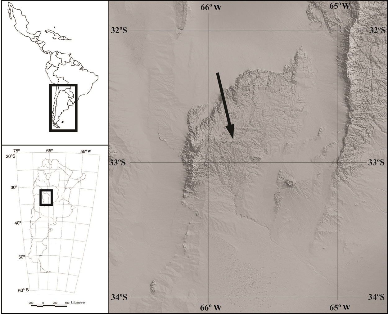
Figure 1. The location of Intihuasi Cave, indicated by the arrow.
The excavation carried out in 1951, as well as the radiocarbon dates obtained, allowed González (Reference González1960) to build the first chronological sequence in the entire SCSA. González identified four “cultural horizons” (Intihuasi I to IV), organizing the whole sequence from projectile points, considered to be diagnostic elements. Level IV would represent the first inhabitants, with their characteristic technology: lanceolate projectile points called Ayampitín. Radiocarbon dates indicated that the initial occupations of the cave took place at the beginning of the Middle Holocene, 7970 ± 100 BP and 8068 ± 95 BP (González Reference González1960). The stratigraphic studies, conducted at the same time by Cappannini (Reference Cappannini1955), were an outstanding contribution to the chronological sequence. The sedimentary column made inside the cave was 11 m thick and allowed the identification of six layers (I to VI, from top to bottom). The deepest part of the deposit was developed on a reddish-brown loessic layer (IV) and was assigned to the Pleistocene. Layers II and III included the cultural materials studied by González (Reference González1960). Level I was composed by 20 cm of goat guano.
After fieldwork conducted by González, the Intihuasi Cave was never re-excavated. The absence of new studies could be explained by two facts: the lack of interest in developing long-term research in San Luis (Heider and Curtoni Reference Heider and Curtoni2016), and the belief that no place remained undisturbed in the site. In fact, González excavated the entire inside half of Intihuasi (Figure 2). Additionally, the outside part of the cave was affected by the provincial road administration while leveling and paving access. Currently, almost 70 years later, an agreement between the government of San Luis Province and the National University of San Luis has allowed research to restart. Our main interest was to discuss again and update the original archaeological data on chronology and its implications for regional human occupation. In this sense, we consider current population models that follow some biogeographical postulates (Laguens Reference Laguens2006–2007; Rivero Reference Rivero2012). The archaeological studies focused on the performance of exploratory test pits in different sectors of the cave and the slope (Figure 2). The studies carried out provide us with new chronological information to discuss the original archaeological results and their implications for the process of regional population.

Figure 2. (A) Original area excavated by González (Reference González1960); (B) location of the present test pits (numbered in circles), placed on González's original modified map; (C) image of the test pits in the main cave, taken from the outer slope (photo by Guillermo Heider). (Color online)
Methods and Results
The test pits conducted in the Intihuasi Cave were distributed in 12 sectors that included the inside and the slope sections, corresponding to the undisturbed and unexcavated spaces. Each test pit was 1 × 1 m, with arbitrary excavation levels of 10 cm. Results were uneven in terms of the reached depth, the nature and quantity of remains, and, consequently, the availability of materials that could potentially be dated. The results of the tests showed the presence of a minimal undisturbed space, in the boundary between the excavation carried out by González and the tasks performed by the provincial road administration (Figure 2).
Test pit 4 showed a stratigraphy or succession of horizons that we consider structurally natural (Supplemental Table 1). The deposits of the upper layers (M3 to M6) are dominated by sand and mud (silt and clays). Here, the presence of gravels (blocks) stands out when considering the volume/weight ratio. The main difference between levels M4 and M3 is the modification in the color of the sediments, which are dark brown and reddish brown, respectively. Finally, M2 and M1 are silt or sandy silt, with different amounts of gravel in lenses, separated by a net contact.
All the recovered material is currently under study. In situ observations and posterior geoarchaeological studies led us to focus on the analysis of test pit 4, which was excavated up to a depth of 80 cm from the current surface of the floor. The arbitrary levels that we followed were reordered into six layers, considering the stratigraphic study of the excavation wall. During the cleaning of the surface of level M6, 7 cm from the surface, an Ayampitín projectile was recovered. Because it is an initial level, and given the high traffic in the cave, we do not classify the finding as fully stratigraphic. The 14C date of 8640 ± 30 BP (charcoal, Beta–532731) was obtained from a sample collected in layer 5, between 25 and 30 cm deep (Figure 3). The range of calibrated dates is 9627–9490 cal BC, obtained with Oxcal v.4.4 (Bronk Ramsey Reference Bronk Ramsey2009) and ShCal20 curve (Hogg et al. Reference Hogg, Timothy Heaton, Jonathan Palmer and John Southon2020).

Figure 3. Recent excavation of test pit 4. Arrows indicate the provenance of the radiocarbon sample and the location of the Ayampitín projectile point (photo by Guillermo Heider). (Color online)
Test pit levels M4 to M6 can be correlated with levels 2 and 3 of González's original excavation (Supplemental Figures 1 and 2). These original levels were described as strata laden with loose rocks in the sediment, bone accumulations, and dark lenses of carbonized substances (González Reference González1960). Levels M2 and M3 may represent a transition between the cultural levels of the current roof of the profile and the Pleistocene loess of the floor (M1). In this level, the change of coloration of the material to reddish brown with presence of gravels indicated by González as levels 5 and 6, lacking an archaeological record, can be observed.
Discussion
At the beginning of the twentieth century, the Pampean Hills were considered a marginal portion of the archaeological region called Northwest Argentina (NOA). Progress has also been made in the characterization of the different periods, validating the original master sequence by González (Reference González1960). In the described context, the new radiocarbon date for Intihuasi is relevant for the discussion of the peopling of the region in particular, and of the Southern Cone in general. In the first place, because it comes from the site where the first master sequence for an important portion of South America was built, and secondly, due to the site's time–space location in relation to the current occupation models for central Argentina.
Two peopling models have been put forward on the basis of the currently available data. Laguens (Reference Laguens2006–2007) proposes, from the landscape ecology perspective, a continuous occupation since the end of the Pleistocene. In contrast, Rivero (Reference Rivero2012) suggests that there is a hiatus in the archaeological record of the Early Holocene that could be the result of a failed occupation and a subsequent recolonization of the landscape. Both authors coincide on the predominance of an east–west peopling vector. To Rivero (Reference Rivero2012), the new exploration and recolonization of the region began at the end of the Early Holocene and the beginning of the Middle Holocene. The increase in the regional archaeological signals at around 8000 BP and the appearance of a new weapon system (the Ayampitín lanceolate projectile points) would indicate a new west–east vector colonization. This new occupation would have its starting point in the archaeological record at 8068 ± 95 BP, the original radiocarbon date for the Intihuasi Cave (González Reference González1960; Rivero Reference Rivero2012).
The new date presented in this report may be relevant to this discussion. The initial occupation, clearly located in the Early Holocene at approximately 9627–9490 cal BP (8640 ± 30 BP), shortens the hiatus observed in the record by Rivero (Reference Rivero2012). However, we understand that it does not modify the west–east population vector. This might have taken place from the Early Holocene as part of a macroregional process that included at least the center-west of Argentina and the center of Chile. The integration process was originally proposed by Schobinger (Reference Schobinger1988), from the historical-cultural paradigm, as an Andean horizon of bifaces. The current data, emerging from diverse conceptual frameworks and new lines of evidence, allow us to confirm that lanceolate projectile points are a diagnostic technological element of this process. In fact, the formal continuity and temporal overlap of lanceolate points during the Early and Middle Holocene in different Andean and extra-Andean sectors of the Southern Cone are outstanding (Hoguin Reference Hoguin2014; Klink and Aldenderfer Reference Klink, Aldenderfer, Stanish, Cohen and Aldenderfer2005; López and Restifo Reference López and Restifo2014; Martínez Reference Martínez2003; Pautassi Reference Pautassi, Martínez and Bozzuto2011, among others). In this sense, the existence of an interaction and band movements at the macroregional level, with links to both Andean mountain ranges, which included the Pampean Hills, has been proposed (Cortegoso Reference Cortegoso2005; García Reference García2005; Heider and Rivero Reference Heider and Rivero2018; Jackson et al. Reference Jackson, Antonio Maldonado, Seguel and Vialou2011). The new dating is concrete evidence, consistent with the proposed peopling process. A single Ayampitín projectile point is still weak, albeit promising, evidence to support that process.
In summary, the new date of the Intihuasi Cave can be understood coherently with a colonization process that was initiated in the Early Holocene (Rivero Reference Rivero2012). Different authors have suggested that the first explorations of the Pampean Hills and their adjacent plains responded to cognitive maps from the Pampas region (Laguens and Alberti Reference Laguens and Alberti2019; Rivero and Heider Reference Rivero and Heider2020; among others). In contrast, the peopling of the Early and Middle Holocene suggests that a rapid expansion originated in the Andean world. The clustering of dates at the macroregional level since around 9000 BP, as well as a lithic technology with common features, may be indicative of a rapid occupation during the Early Holocene. Updating the temporality of the original master sequence for the macroregion may reinsert Intihuasi and the region into the discussion about antiquity and documentable population vectors in the archaeological record (Prates et al. Reference Prates, Politis and Ivan Perez2020).
Acknowledgments
To the Secretary of Culture of San Luis province; to the authorities of the National University of San Luis; to Native peoples for their constant interaction; to our lab partners (Lic. Icazzatti). To all the inhabitants of the La Carolina who collaborated in the excavation. We appreciate language revision by staff from the Instituto de Lenguas, Universidad Nacional de San Luis. To the reviewers and editors for their suggestions to improve the manuscript.
Data Availability Statement
The data and materials presented are available in the Departamento de Geología, Universidad Nacional de San Luis, Argentina. The bases of data can be requested from the authors through the contact provided.
Conflict of Interest
The authors declare none.
Supplemental Material
For supplemental material accompanying this article, visit https://doi.org/10.1017/laq.2022.36.
Supplemental Figure 1. General scheme of cave A (modified from González Reference González1960). Red box in the profile indicates the approximate sector of test pit 4.
Supplemental Figure 2. Ideal model of the stratigraphic profile of Intihuasi (modified from González Reference González1960). Red box indicates approximate stratigraphic position of test pit 4 within the original scheme.
Supplemental Table 1. Results of stratigraphic studies and total number of archaeological materials recovered.


